Canada VFR Flight Plan 06
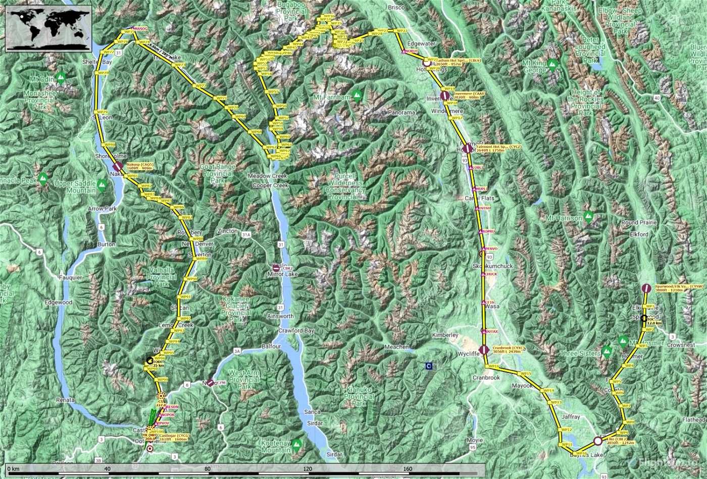
06 FL85C06 BC mountain flight to msfs detailed Castlegar CYCG.
VFR flight through Canadian BC rockie mountains with final landing at
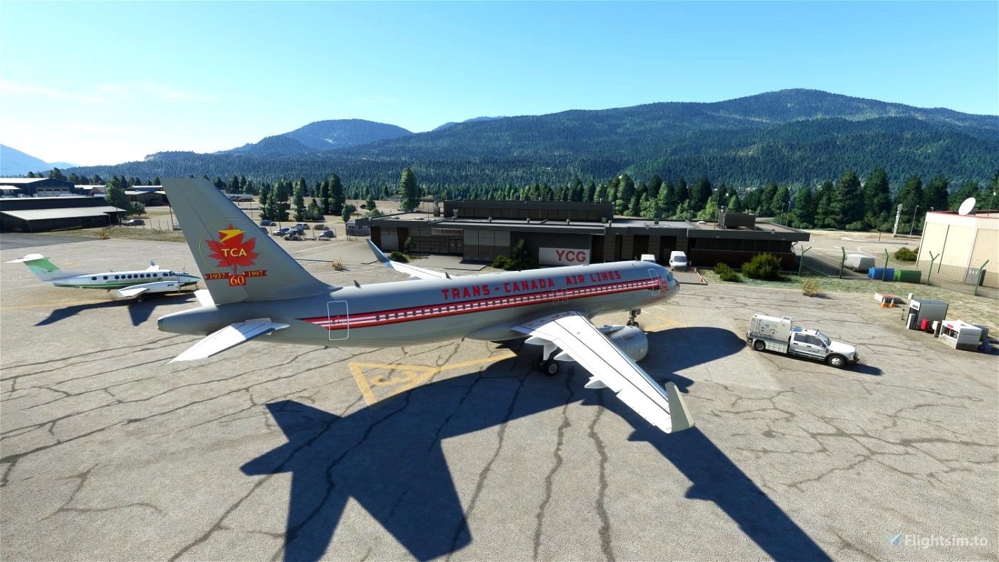
msfs detailed Castlegar CYCG (West Kootenay Regional Airport).
670km, 5000ft altitude, 2 hour 20 minutes in aircraft at 155kts.
Choose your own altitude for low level flying.
Safe altitude is 10500ft, mostly safe at 5000ft.
Heavy use of user created waypoints, over 100.
Departure Sparwood Elk Valley CYSW runway 17 1210m 3800ft alt.
Destination Castlegar CYCG runway 15 1606m 1618ft alt.
There are 7 airfields, several sharp turns and heavy altitude increases.
Contents 1) littlenavmap flight plan 2) msfs flight plan 3) text info file.
4) assorted screenshots.
x

 NightHawk1867

