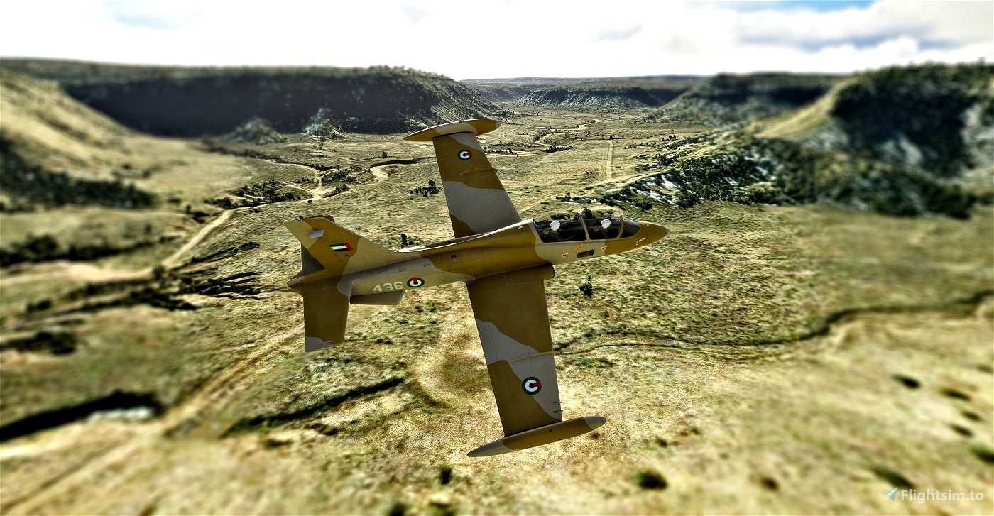


This is a collection of basic flight plans for North American low level Military Training Routes (MTRS) which permit terrain following operations. We all like to fly too low and too fast at times; these plans allow you do so where it is actually permitted (for the military at least)!
MTRS are shown on the US VFR Sectional charts (light grey lines with IR or VR followed by a number numbering and directional arrows in black). THESE PLANS ARE FOR ENTERTAINMENT PURPOSES ONLY, NOT FOR REAL WORLD NAVIGATION.
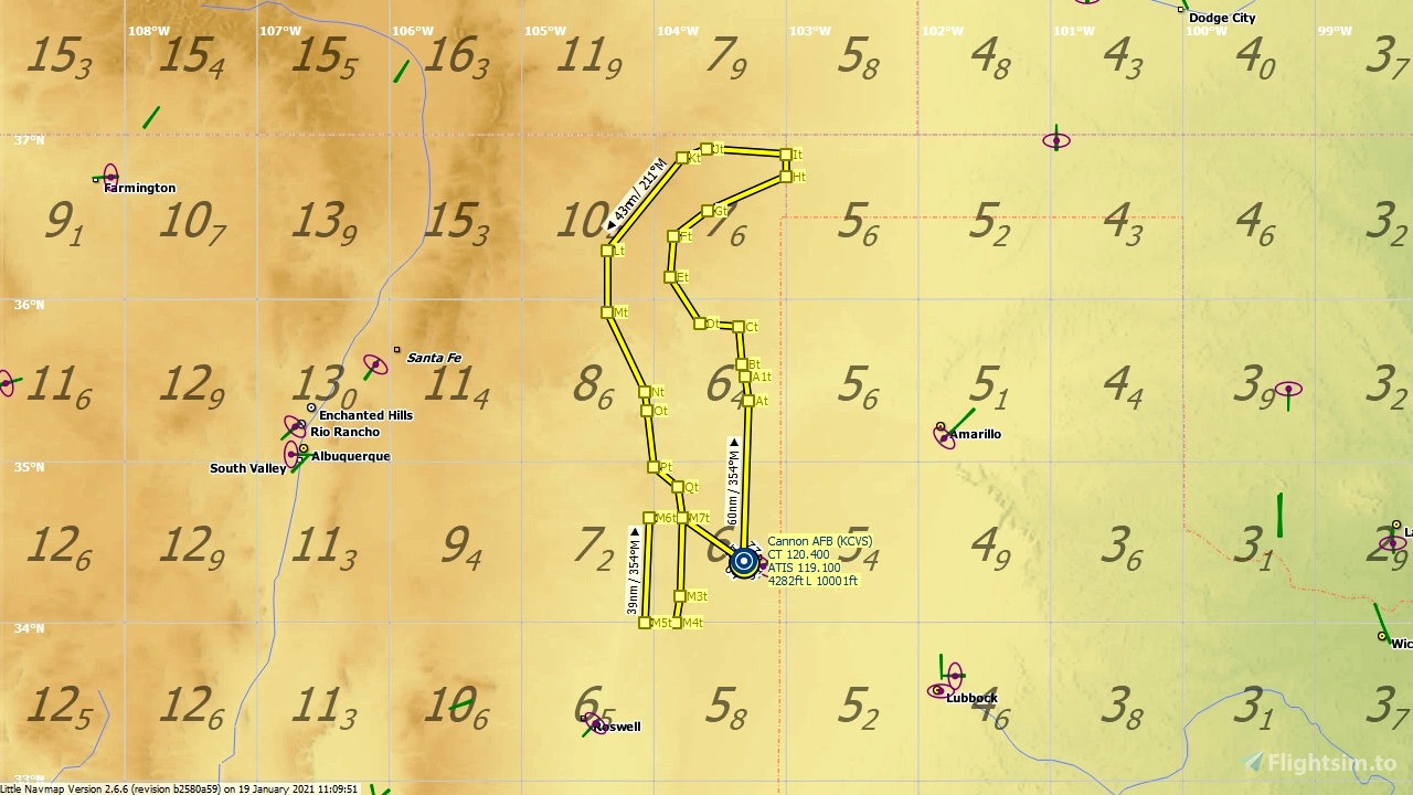
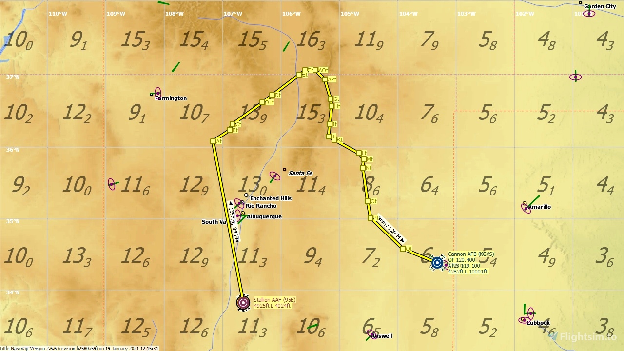
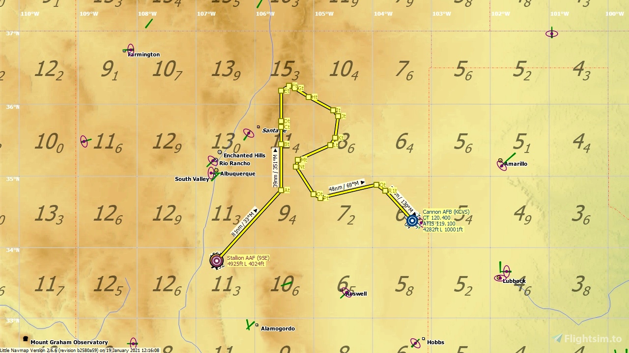
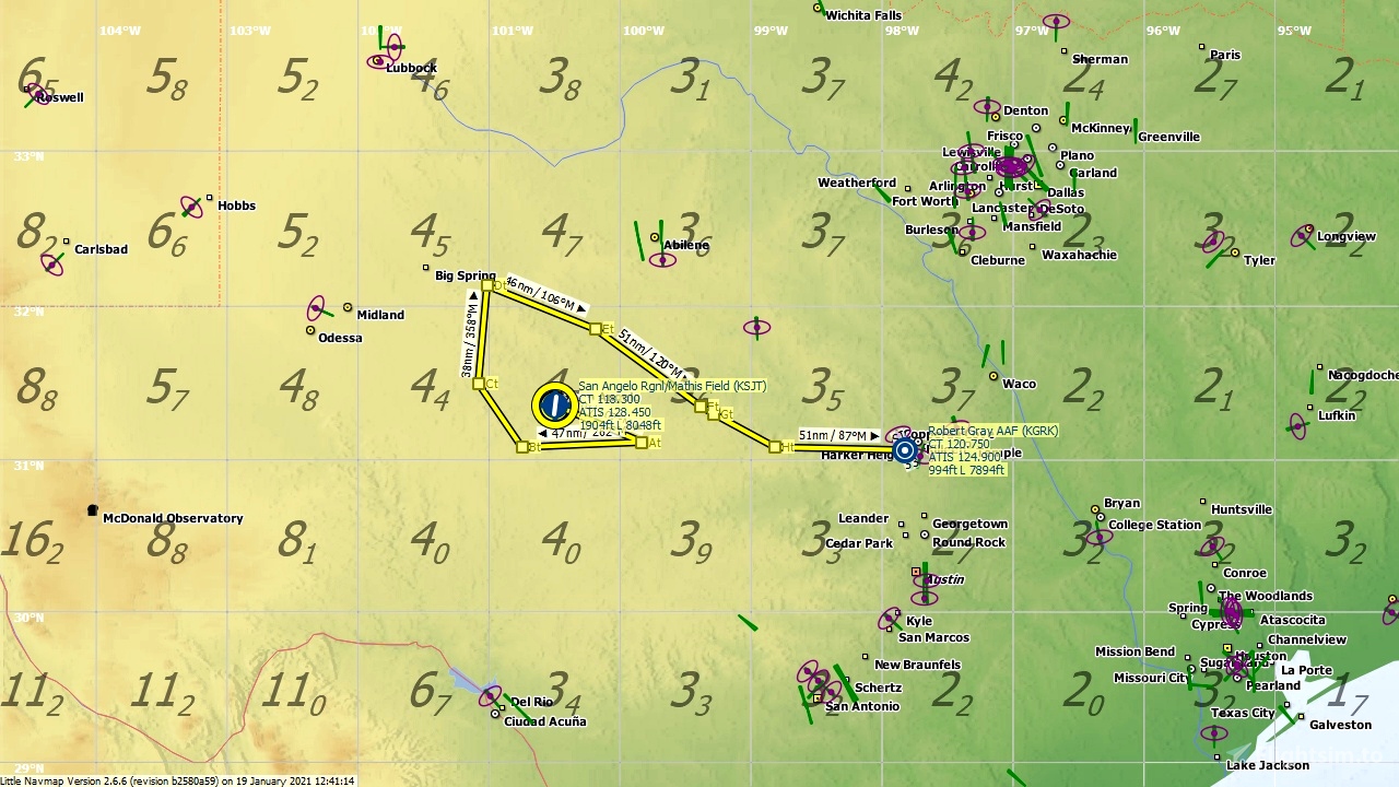
Pack 3 contains routes IR-105 through IR-126 (12 in total), in Microsoft Flight Simulator 2020 (PLN) format and Littlenavmap (LNMPLN) format (which may be exported to other simulators).
About The Routes
There are two types of MTR included here:
1. IFR Military Training Routes. These are numbered IRnnnn for routes with no segments above 1,500ft AGL and IRnnn for routes that include segments above 1,500ft AGL. The military are permitted to fly these in both IMC (some exceptions) and VMC below 10,000ft MSL at airspeeds in excess of 250 KIAS.
2. VFR Military Training Routes. These are numbered VRnnnn for routes with no segments above 1,500ft AGL and VRnnn for routes that include segments above 1,500ft AGL. The military are permitted to fly these in VMC below 10,000ft MSL at airspeeds in excess of 250 KIAS. VMC minimums are 5 miles visiblity and a ceiling of no less than 3,000ft AGL.
Only routes which permit terrain following operations for part or their entire length are included.
Slow speed SR routes also exist and are flown enitrely below 1,500ft AGL at or below 250 KIAS. These are not shown on the sectional charts and are not contained in this pack.
Flying
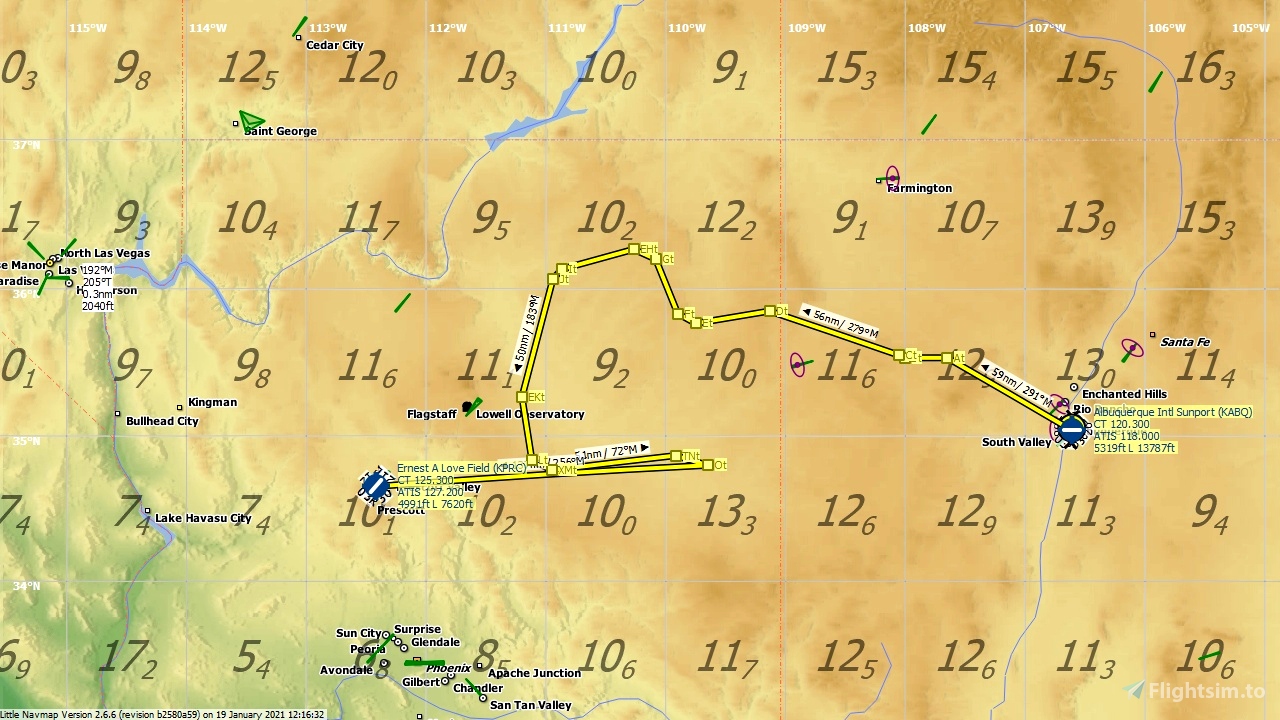
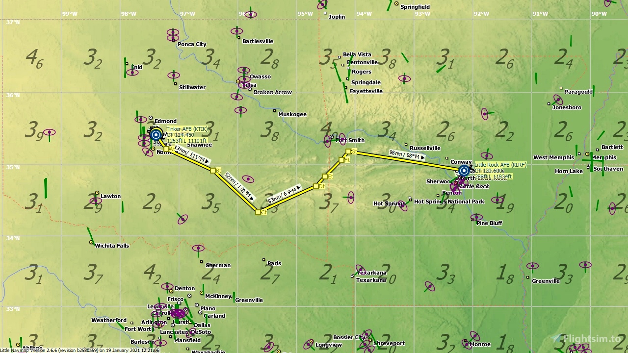
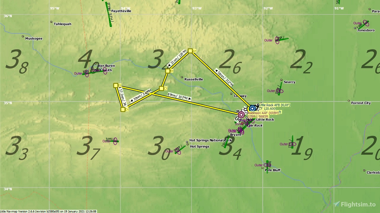
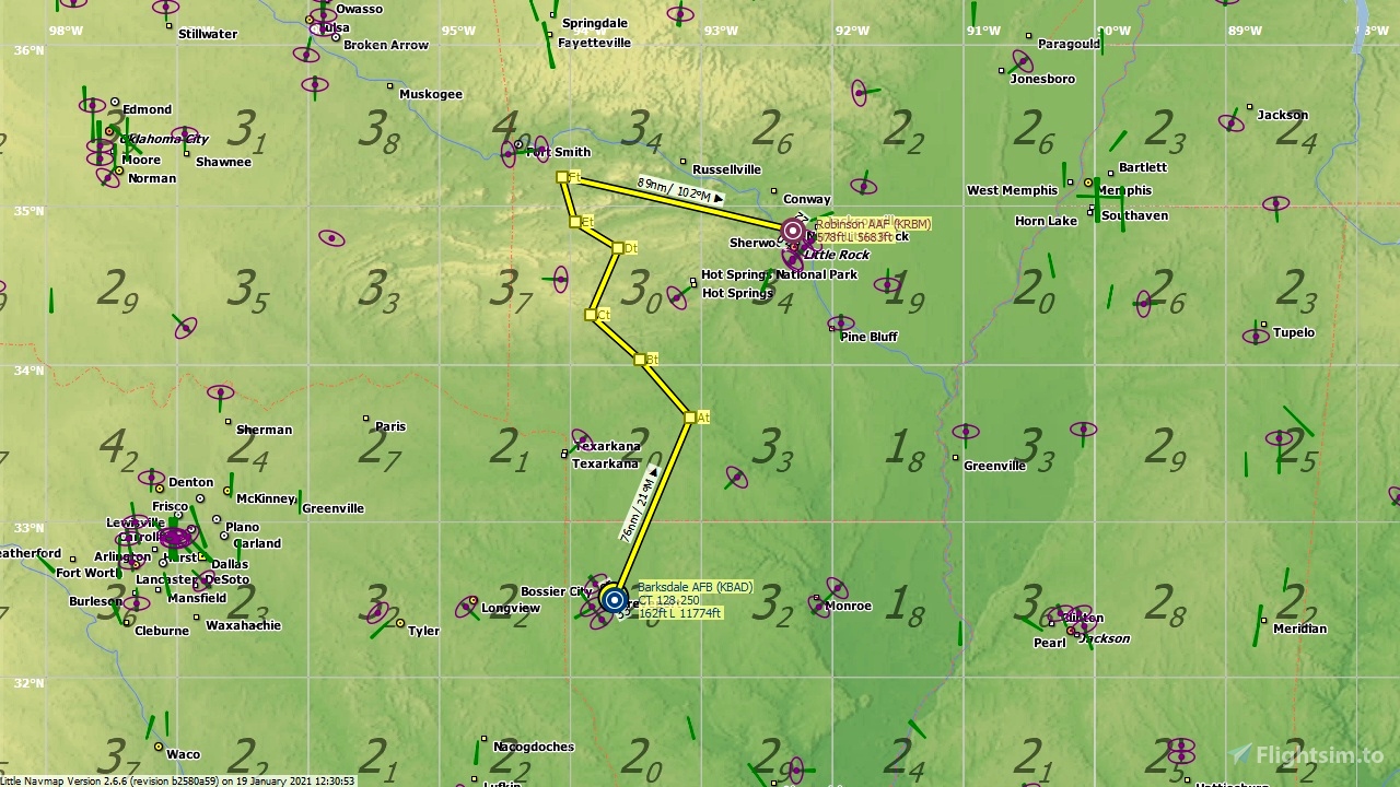
Route waypoints are labelled A, B, B1, B2, C, etc. in the direction the route is to be flown. Waypoints labelled with 't' are those between which terrain following is permitted. E.g. A, Bt, Ct, Dt, E would permit descent to terrain following height passing waypoint B and ascent passing waypoint D.
To fly a route:
- Each plan starts at the nearest military airfield or a Flight Support Centre (FSS) and takes you direct to the route entry at waypoint A. You should select an appropriate cruising altitude to transit to the route. The plans do not include any SIDS, follow airways or respect airspaces, but you may modify them as required to do so. (In reality military aircraft must file and fly an Instrument Flight Plan to the route entry).
- Descend to terrain following height as you pass the first waypoint labelled with 't'. Typically terrain following height is 200ft to 500ft AGL but can be lower or higher depending on topography and aircraft performance. (In reality, there are also specific AGL minimums and MSL maximums for each segment which aren't noted here. See also the note below about FAR 91.119).
- Follow the terrain from waypoint to waypoint, using the topography to your advantage. (Again, in reality there are corridor limits on permitted distance from the route centreline for each segment which aren't noted here).
- Climbing back to a safe altitude when passing the final waypoint in a set labelled with 't'. (In reality, a specific altitude above MSL is specified which isn't noted here).
- Exit the route at the final lettered waypoint, climbing to cruising altitude to transit to your destination. (As above, the military would be required to rejoin a filed Instrument Flight Plan).
- The final waypoint will take you to the original military airfield, FSS or another nearby. The plans do not include STARS, follow airways or respect airspaces, but you may modify them in Littlenavmap as required to do so.
NOTE: The plans were created in Littlenavmap, which does not allow variable waypoint altitudes. For simplicity the plans have generally been set at a default 9,000ft MSL which is 1,000ft below the ceiling for MTRS. Thus it is for the user to determine the correct altitudes when setting up the flight plan.
NOTE: In reality some routes may have alternate entry and exit points or connections to other routes which aren't included here.
NOTE: FAR 91.119 applies to military low-level flying, i.e over congested areas NLT 1,000ft above the highest obstacle in a 2,000ft radius, over other than congested areas NLT 500ft AGL, over open water and sparsely populated areas NCT than 500ft to any person, vessel, vehicle or structure.
NOTE: Military flying on these routes is required to avoid airports by 1,500ft AGL or 3NM laterally where practicable.
Installation
Unzip the contents to a convenient location on your PC.
Optional:
Install and use the free Littlenavmap application (littlenavmap.org). Connect Littlenavmap to your simulator and load the desired corresponding LNMPLN file before commencing your flight. If you wish to add any SIDS, STARS, change cruising altitude or make changes to your depature or destination airfields you can do so and re-export the plan in the appropriate format for your simulator.
Microsoft Flight Simulator 2020:
- Open the World Map and use the Load/Save option to load the PLN file for your desired route prior to starting your flight. (Obviously if you have modified the plan in Littlenavmap as described above, ensure you load an exported version of it, not the original PLN supplied in the ZIP).
Other Simulators:
- Install and use the free Littlenavmap (littlenavmap.org). Load the LNMPLN file for your desired route and then use one of the "File -> Export..." options to export a copy of the plan in the required format for your simulator. Load and fly the plan as you normally would.

 amonynous

