


V 3.9
There 2 folders in this download - So don't forget you need to go down a level to paste them.
In the separate folder I've added the arrestor wires from the Touching Cloud mod to these carriers. Why separate? Some of us (me) might be far too lazy to aim properly and just want to smack into the deck and stop.
Other than that I've cleaned up some mistakes, realigned the ILS, improved a few deck textures and details and added some WW2 Japanese carriers that'll show up in Volume 2 at some point soon.
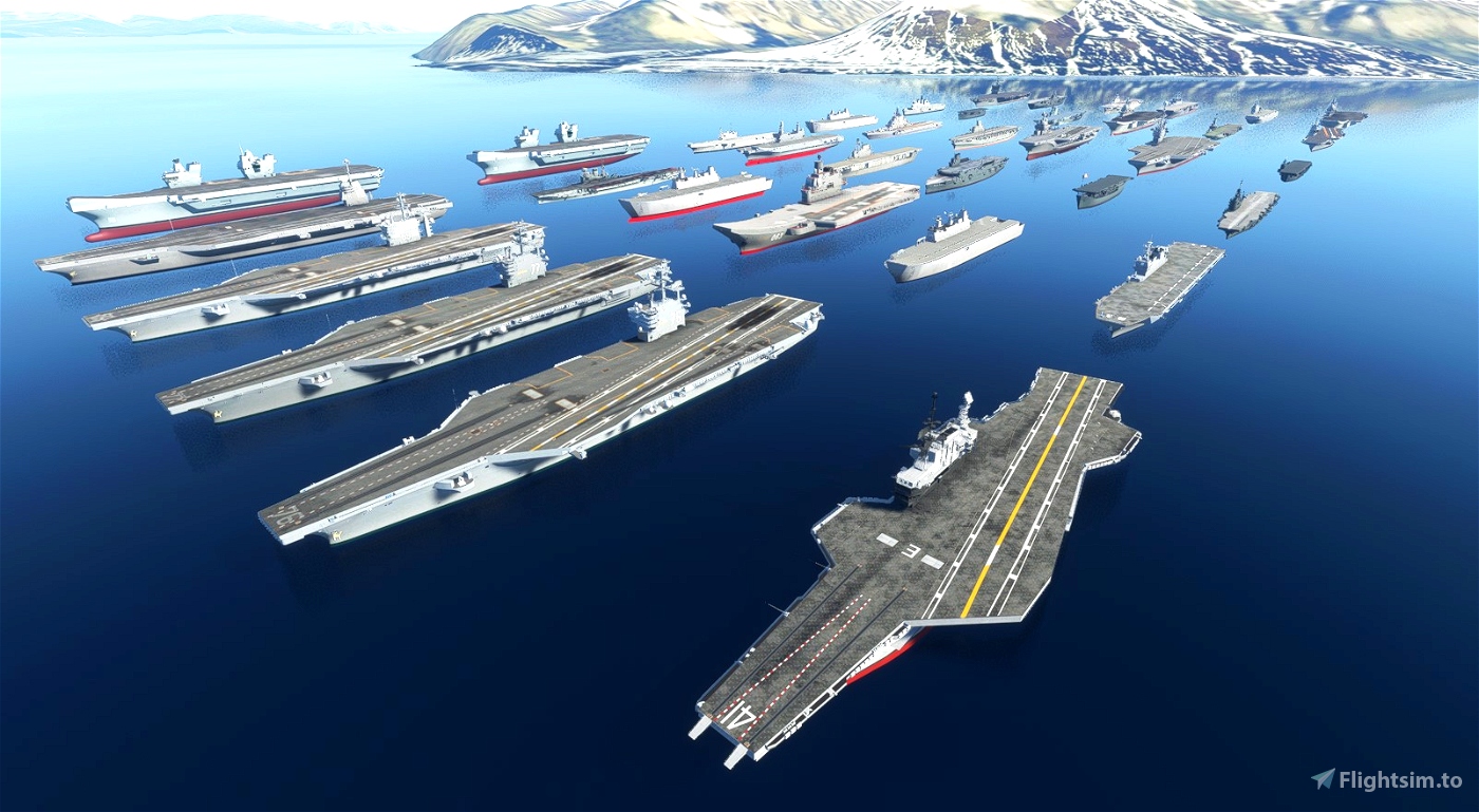
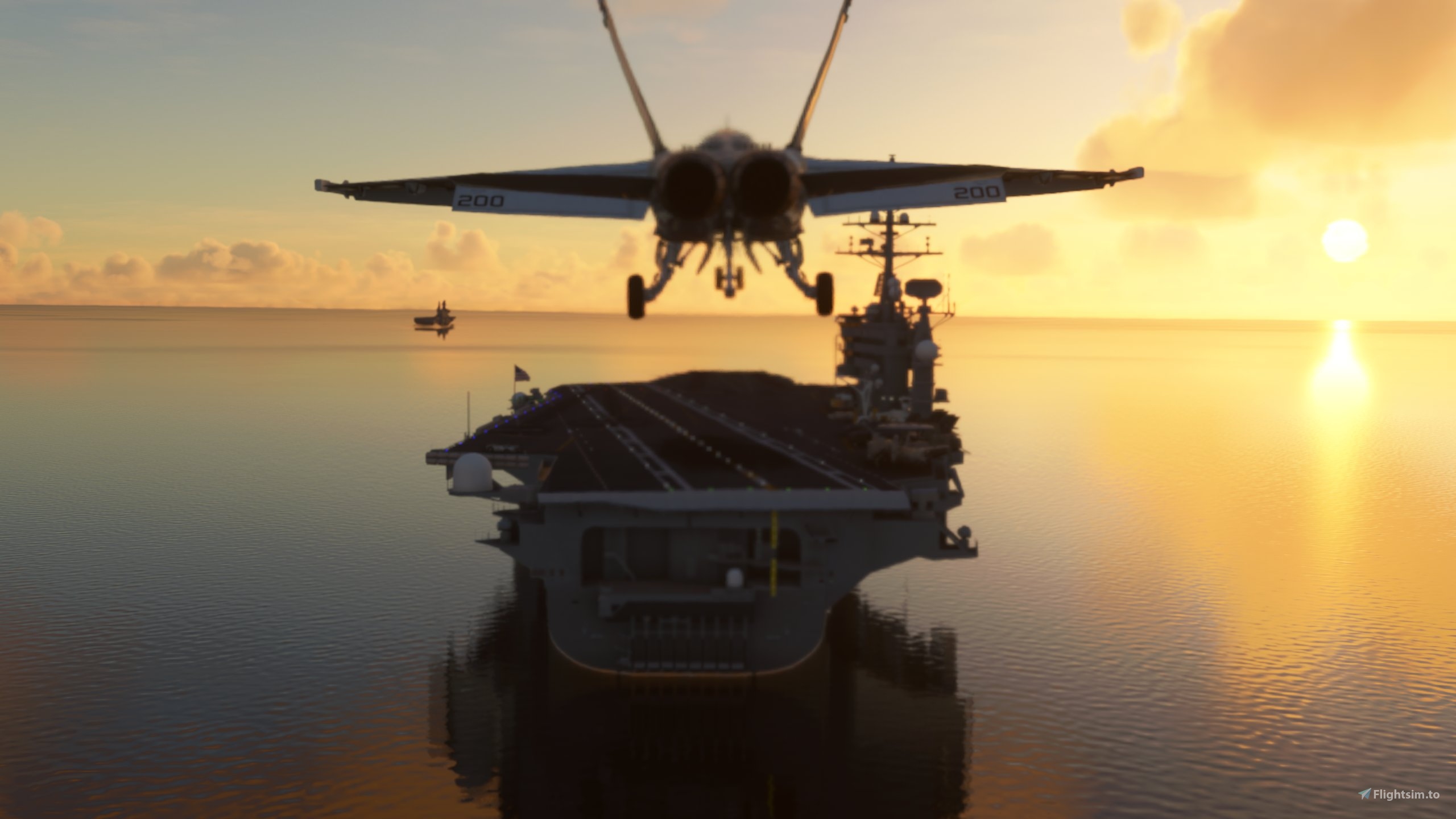
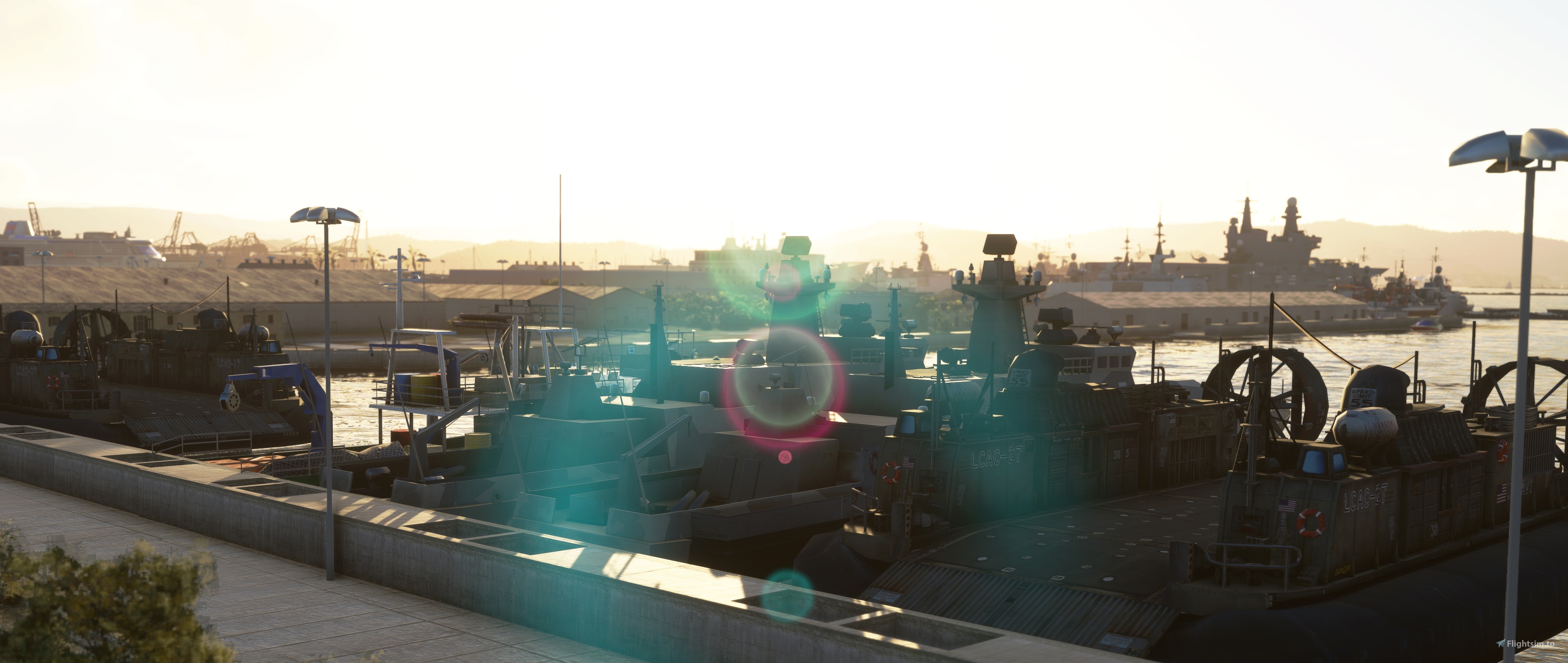
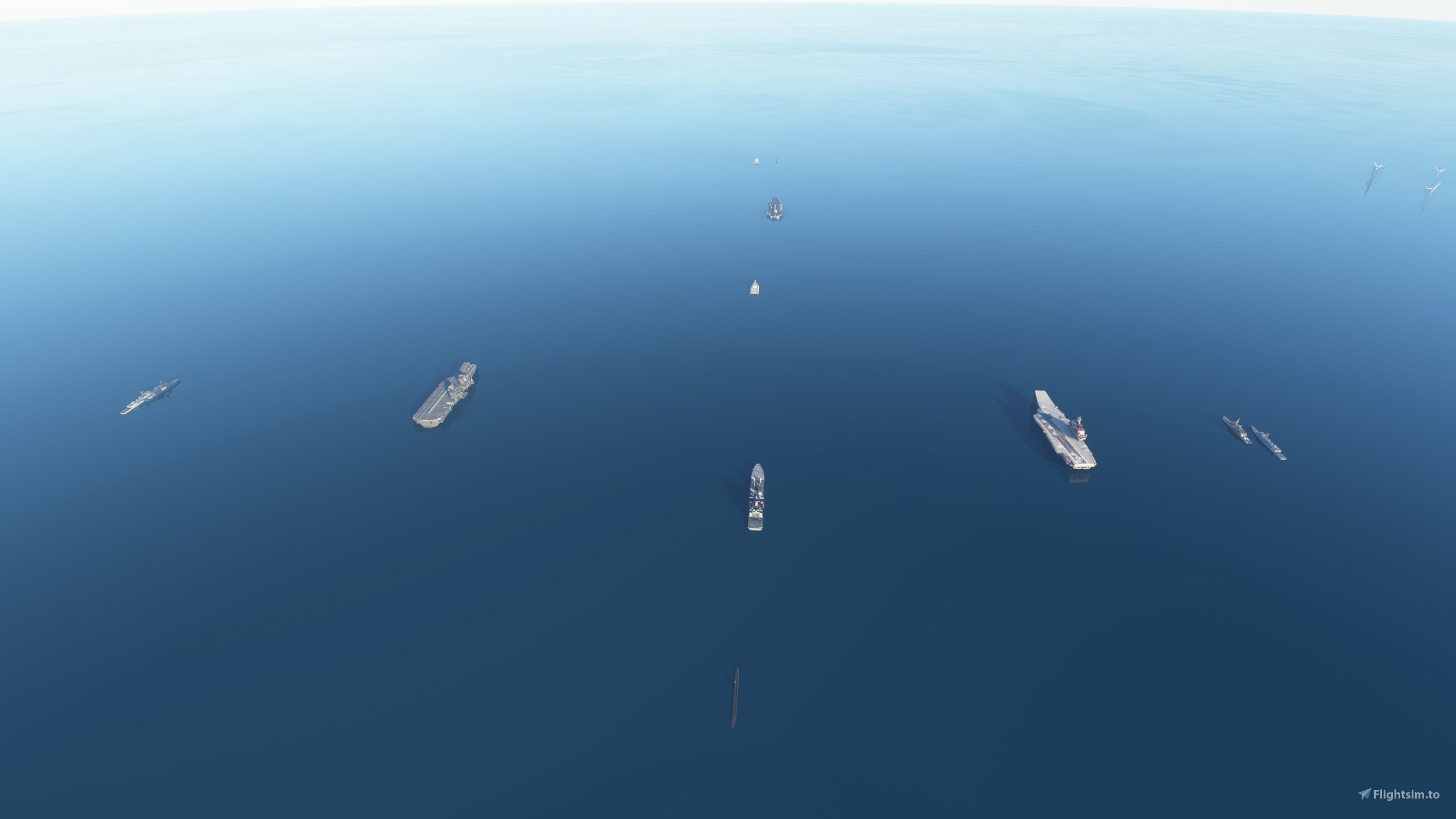
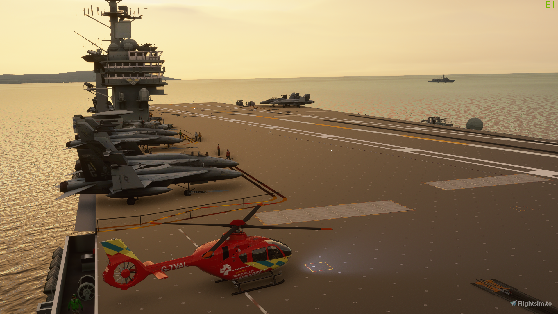
It's aircraft carrier time. This is a carrier group placed in locations around the world.
Volume 2 with new locations is available here - https://flightsim.to/file/18058/aircraft-carrier-group-volume-2
You need this download to use as a library for volume 2.
Google Map of current locations - Google Map of Carrier Locations
Volume 2 locations are in yellow. Newest locations are at the bottom of the side bar.
For proper carrier operations there is a freeware third party program that will give you arrestor and catapult functions at the link below. It works great.
https://msfs.touching.cloud/mods/cloud-assistant/
This mod by TouchingCloud will give the F/A-18 its own carrier functionality which means you don't need to run a separate app - https://flightsim.to/file/23760/f-a-18-super-warrior
For a physical catapult and carrier crew you need to download this by PhotosbyKev which is a package with the relevant times - https://flightsim.to/file/24323/carrier-ops-uss-enterprise
Also the Indiafoxtecho T45 has its own functions too now so worth a try if you have it.
These carriers are nothing more than lumps of terraformed and dried out sea with a model on top. The irritations are down to making them usable airports that'll show up in the map. A dumb surface to land on would look better and be easier to do but would be less usable.
You need to turn off crashes to use these.
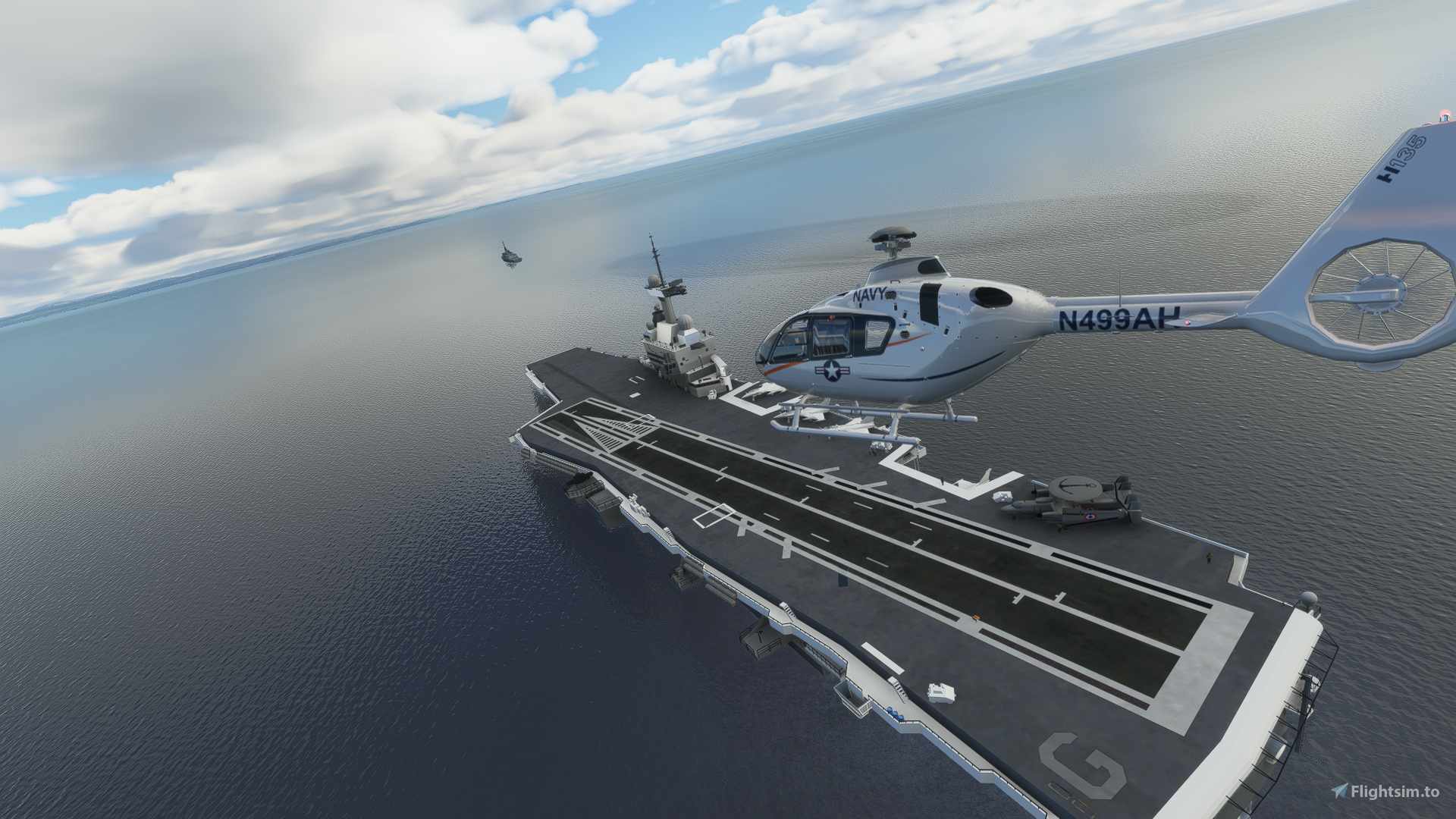
For helicopter fans every single ship, carrier or not, has landable helipads but I may have forgotten a few.
In many locations there are the same three carriers. To make things clearer each ship has the same runway number at each location. If the ships are different the runway numbers start with 04 onwards.
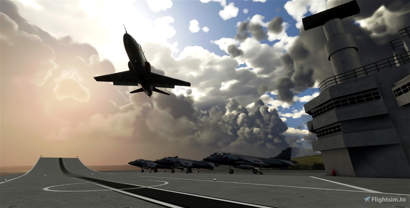
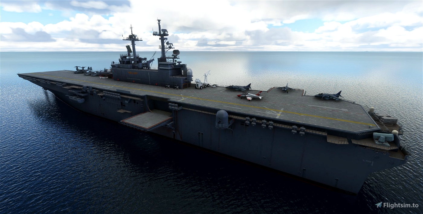
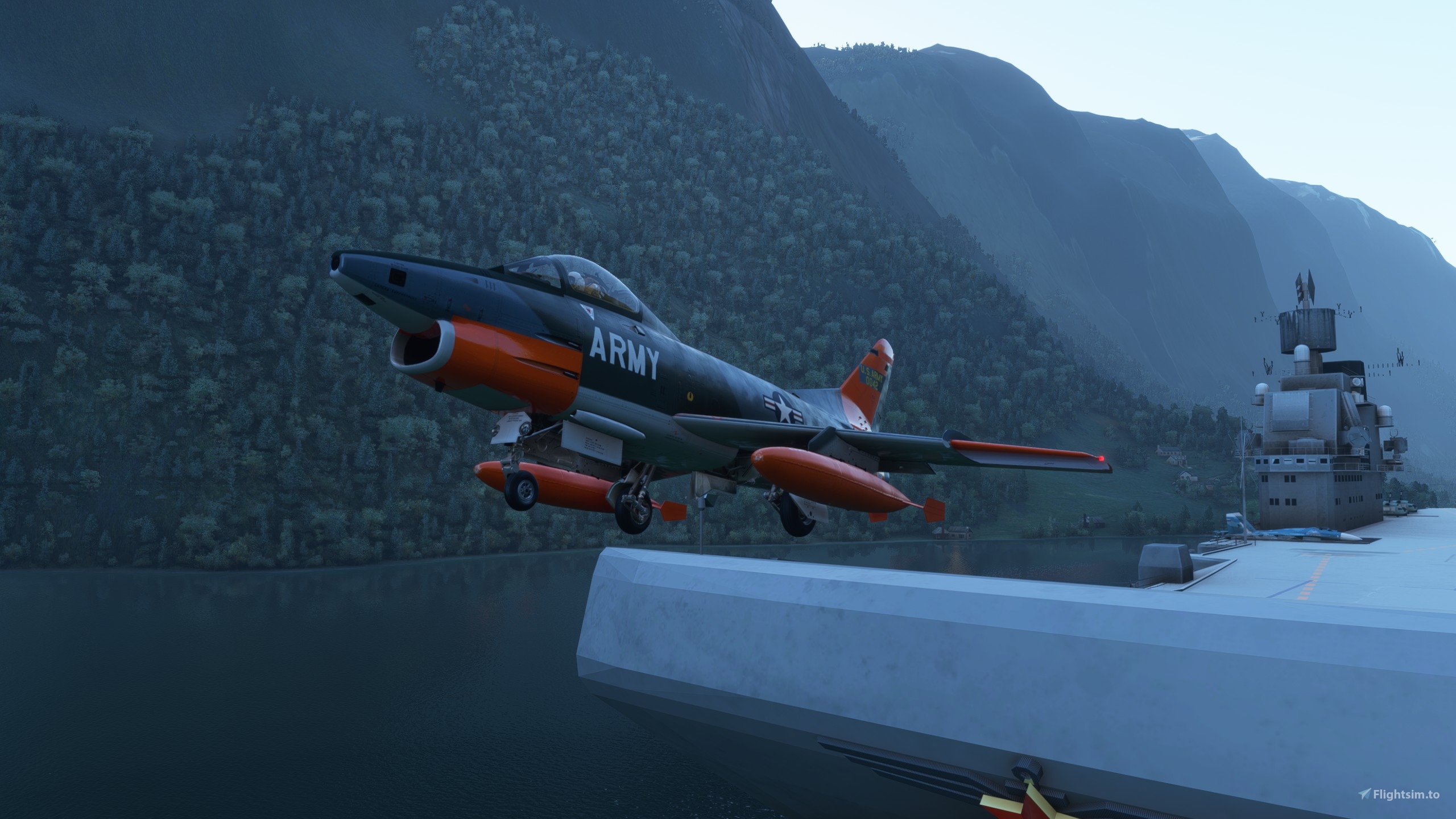
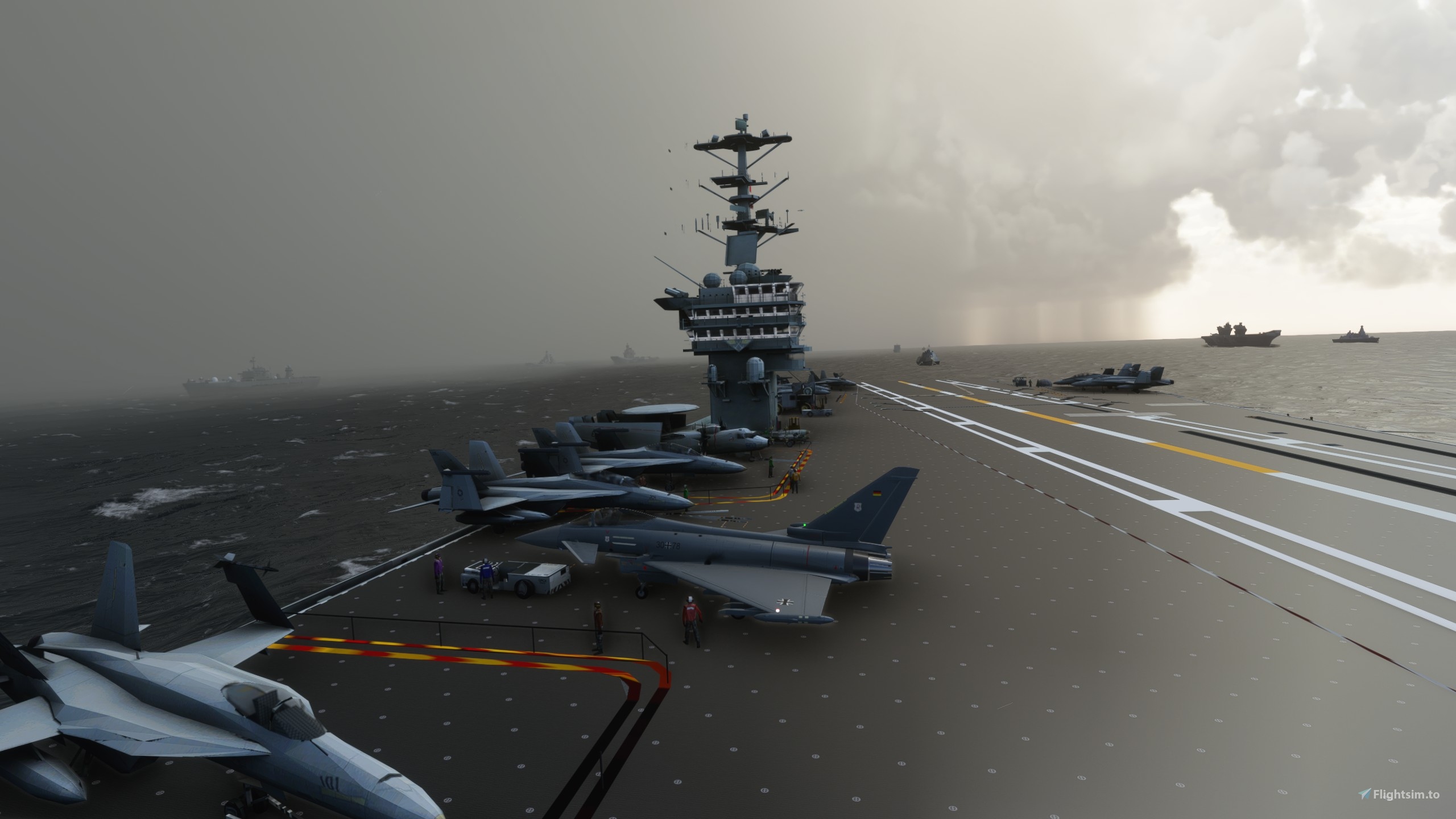
Runway 01 - A HMS Queen Elizabeth at 280 metres.
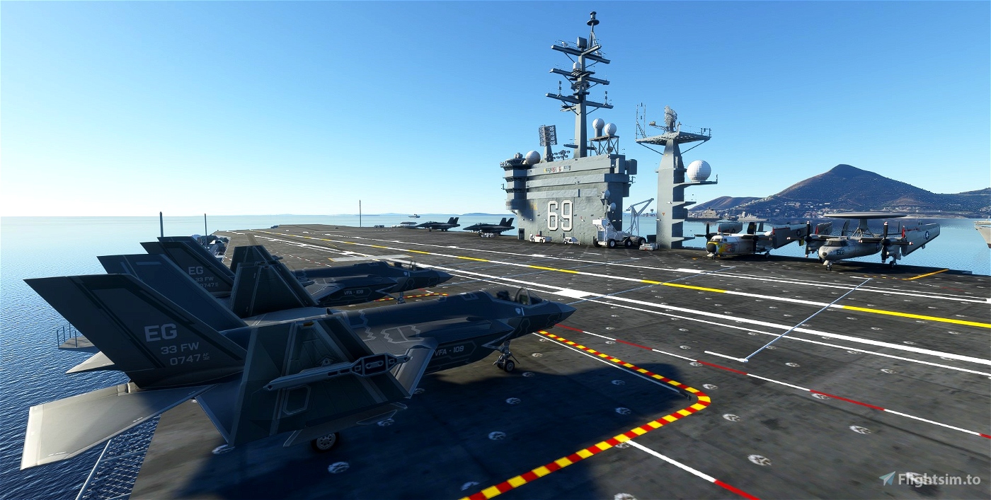
Runway 02 - A Nimitez-esque carrier at around 340 metres.
Runway 03 - An Admiral Kuznetsov at 304 metres.
Why would Russians be trundling around with Americans and Brits? Kaiju of course.
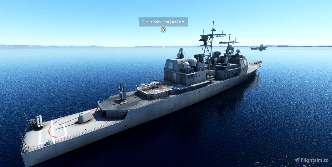
Runway 10 - Is always a helipad on a non carrier such as a frigate or replenishment ship. If there's a helipad on any other ship you can land on it, but this is one you can spawn on.
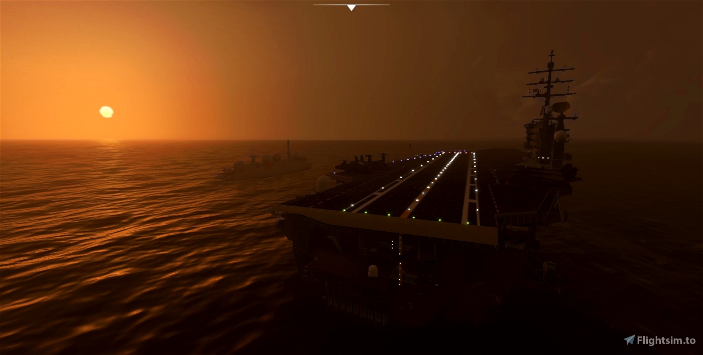
ATC is present. ILS appears in the guts of the file but probably doesn't work. It never does for me. I really need to figure that one out.
Compromises -
There is no pushback and no fuel apart from the oceans carriers. It won't place items outside official terrain, so once you're parked up you might be there for good if you're on the large side.
With the way the runway starts are placed if you're in an airliner you may well be sunk before you start. I'll try to fine tune their location.
These seem to often run a bit choppily for me. This actually starts before I even install a model so there's something going on with the sim either with open water or terraforming in it. Not sure why.
Most of the models do have a hard surface to land on, but the rest of them is not a collision object. Making an entire model collidable is very, very hit and miss so I gave up for now.
The ATC often seems to be rather confused, can't blame them.
Model credits - The Stuc 71, Mandun, Hunter_3ddd, Nikos D, Masahiro M, RK, Yi Tsung Lee, Thomas Berens, Perico 32, Flying Stations team, Pedro Caparos, ArtistX, jocko79, Colin Glendening,
All names begin with 'carrier' so type that in the map screen and a list of them will appear.
Americas
San Francisco in the bay near Alcatraz. ICAO - ACSF. Coordinates - 37.853931, -122.403854
New York in Manhattan. ICAO - ACNY. Coordinates - 40.602660, -74.043143
Carribbean somewhere between the Britsh and American Virgin Islands. ICAO - ACVI. Coordinates - 18.08908, -65.0524
Rio de Janeiro outside the bay but not too far away if you want to pop in to town. ICAO - ACRJ. Coordinates - -23.029428, -43.002231
Norfolk Virginia Out to sea a few miles from Virginia Beach. ICAO - ACNV. Coordinates - 36.858646, -75.814215. Mindless carrier models that aren't runways have been left in the dockyard.
San Diego Close to town and the naval yard. Three carriers are landable but without runways as this is partially on photogrammetry terrain which really, really doesn't like being terraformed. ICAO - ACSD. Coordinates - 32.652786, -117.194432
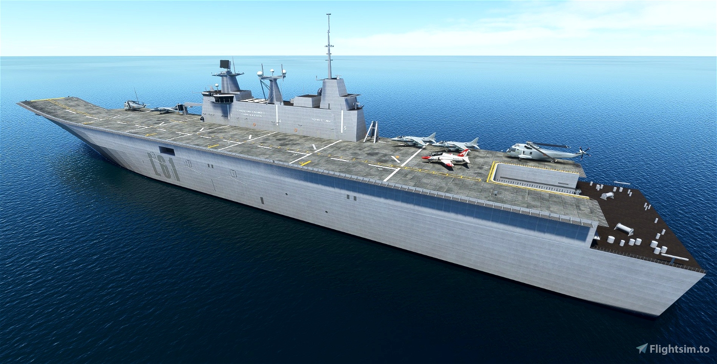
Falklands This is a full blown extravaganza. One regular carrier group . ICAO - ACFM. Coordinates - -51.467110, -61.036887. One HMS Hermes in San Carlos Water. ICAO - ACSC. Coordinates - -51.523275, -59.076374
There are also three ships to find East and North East of Stanley, another HMS Hermes - how odd, HMS Invincible and the, or a, Atlantic Conveyor type thing. They are not airports but they are landable. The models and textures aren't A1. Can't be bothered to correct that right now. I would love to have stuck in a ARA 25 de Mayo and proper period escort ships but there's not much out there.
Hawaii - A few miles out to sea East of Kaho'olawe. ICAO - ACHW. Coordinates - 20.605938 -157.002000
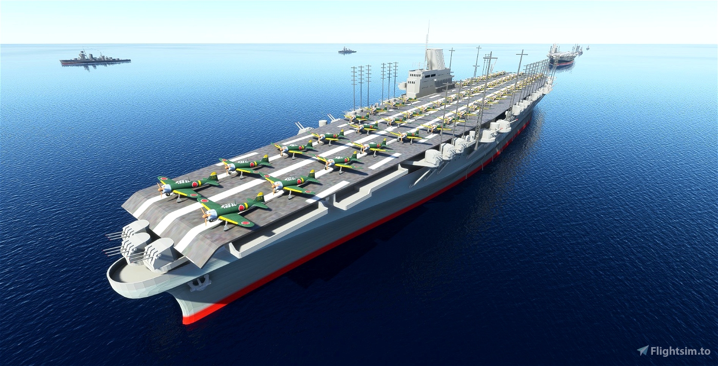
Also included is a mystery location somewhere in the correct historical vicinity of where Japan launched their attack on Pearl Harbour.
There are two carrier groups 25 miles part ish made up of three Shinano class carriers with Kagero class destroyer escorts. You can land on these but they're not airports so can't be found unless you stumble across them.
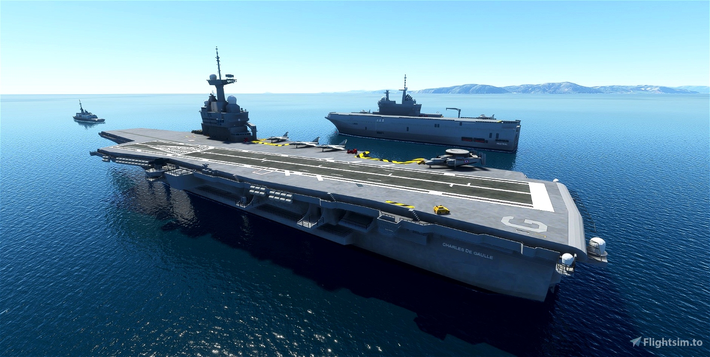
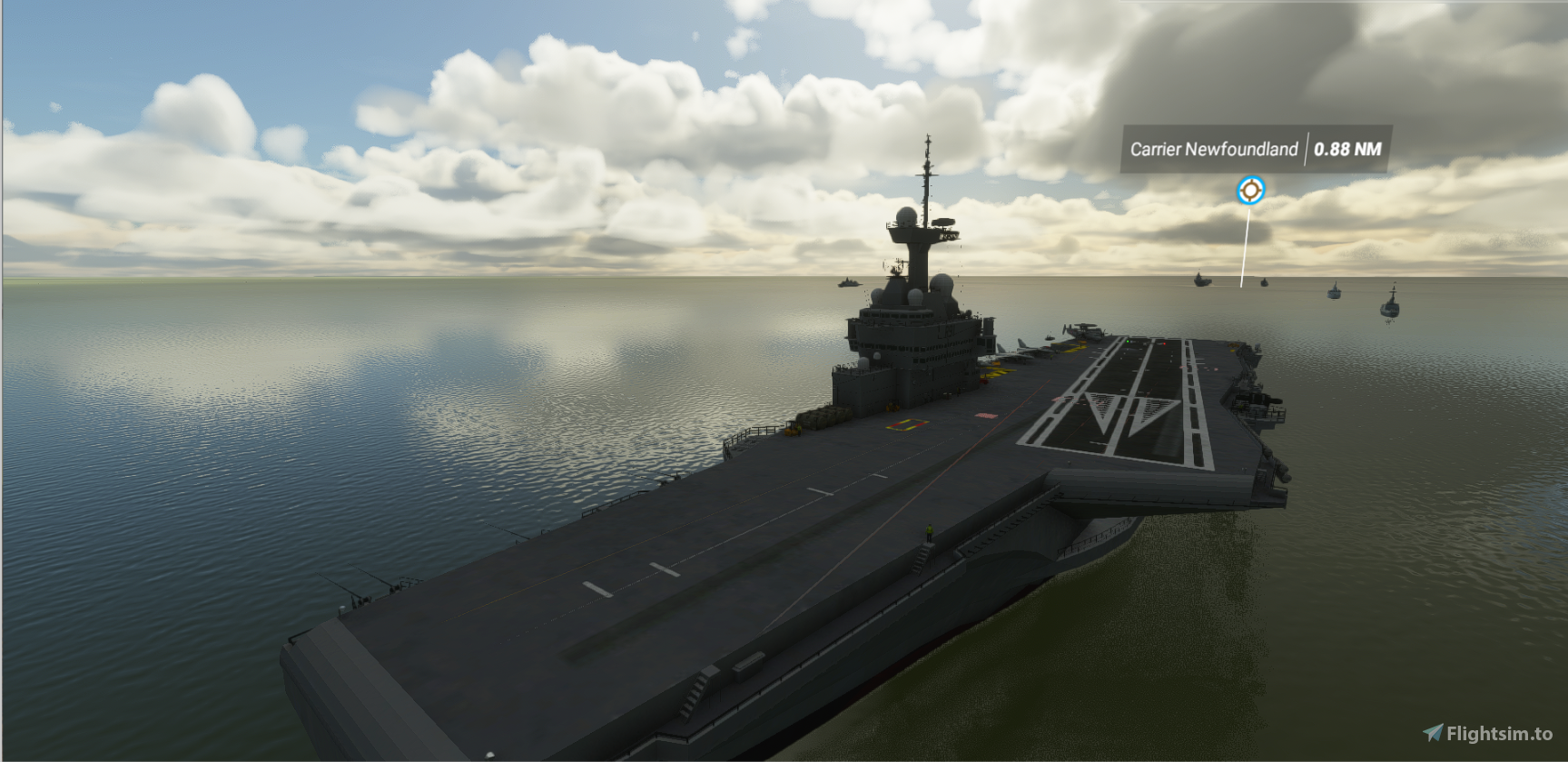
Newfoundland A Charles de Gaulle and Mistral on the SE side of Newfoundland to protect the people of St Pierre et Miquelon from those evil Canadians. ICAO - ACNF. Coordinates - 46.758681 -55.250254
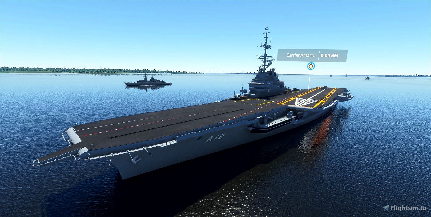
Amazon A lone NAe Sao Paolo 70km east of Manaus. ICAO - ACAM. Coordinates - -3.176956 -59.351552
Galapagos A lone NAe Sao Paolo close to the Galapagos Islands. ICAO - ACGP. Coordinates - -0.039483, -90.313862
Pensecola. Not far from the Naval Air Station. ICAO - ACPC Coordinates - 30.240462 -87.152378
Europe
North Sea not too far from Heligoland. Equidistant to the Netherlands, Denmark and Germany. ICAO - ACNS. Coordinates - 54.72167, 6.995314
Cyprus. The perfect location to play out your nationalist grudges whatever they may be. ICAO - ACCY. Coordinates - 34.80485, 34.24877
French Riviera Just off Cap Ferrat and Nice. Perfect for those want to take class war that little bit further. ICAO - ACFR. Coordinates - 43.581394, 7.419341
Isle of Wight. ICAO - ACIW. Coordinates - 50.595319, -1.443976
There is a mod by Aviationeh to go with this location adding ships to the area - https://flightsim.to/file/5073/isle-of-wight-solent-southampton-ships
Near London - or more like Southend. ICAO - ACLD. Coordinates - 51.496942, 0.663018
Central Liverpool, a lone US carrier. In the water obviously. ICAO - ACLV. Coordinates - 53.404951, -3.007382
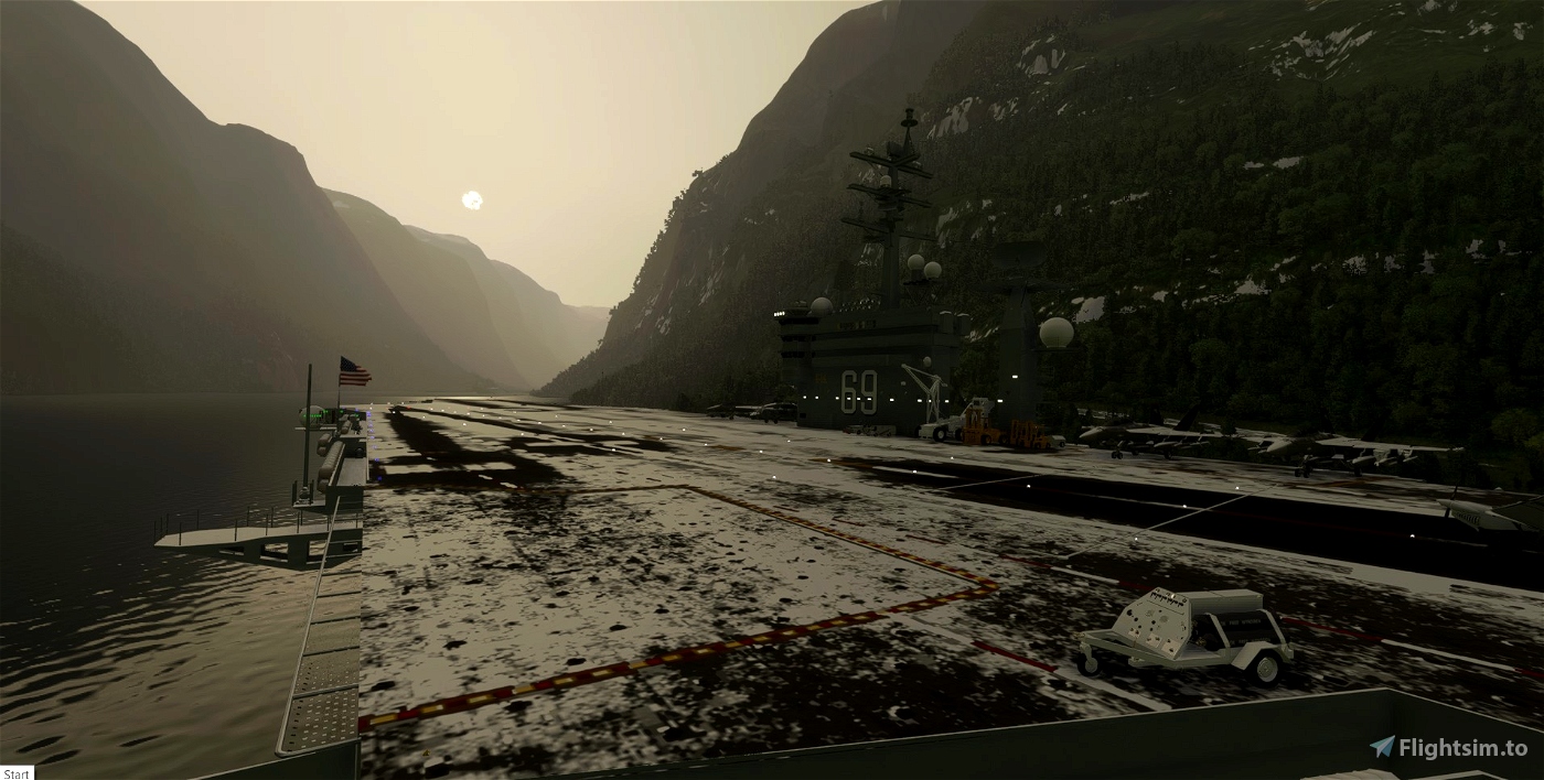
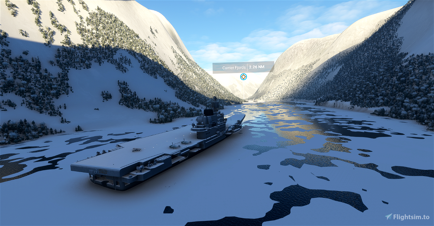
Norway At the end of Sognefjord down in the depths with some very silly landing and takeoff possibilities. ICAO - ACFJ. Coordinates - 60.920062 6.874819
Biarritz A Charles de Gaulle and a Mistral not too far from Biarritz. ICAO - ACBI. Coordinates - 43.596506 -1.613186
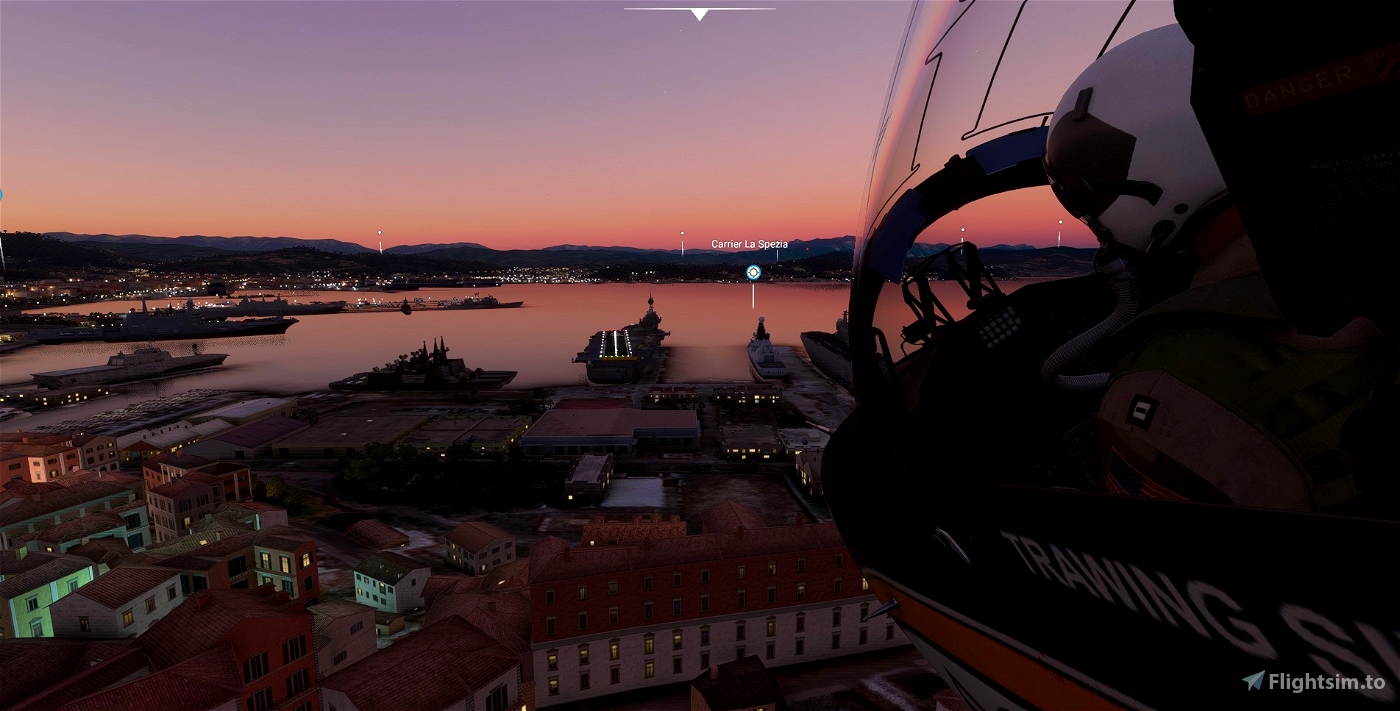
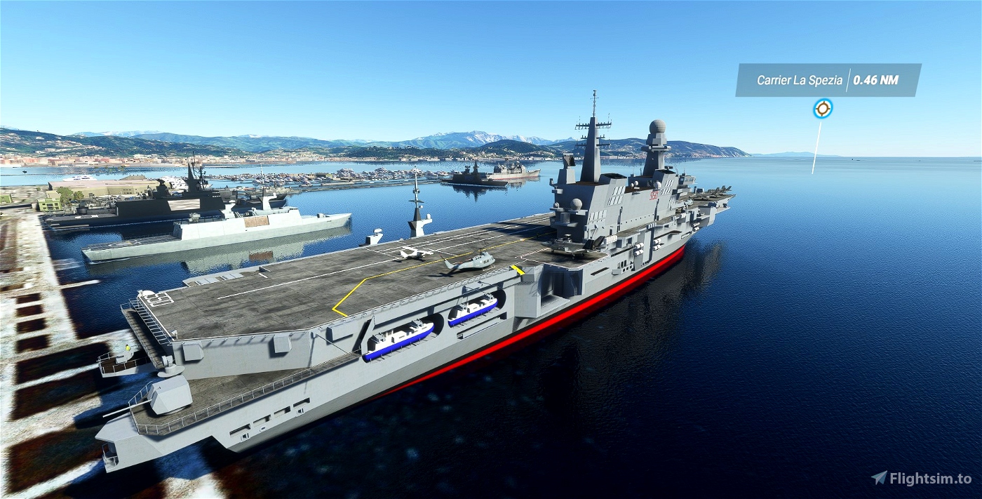
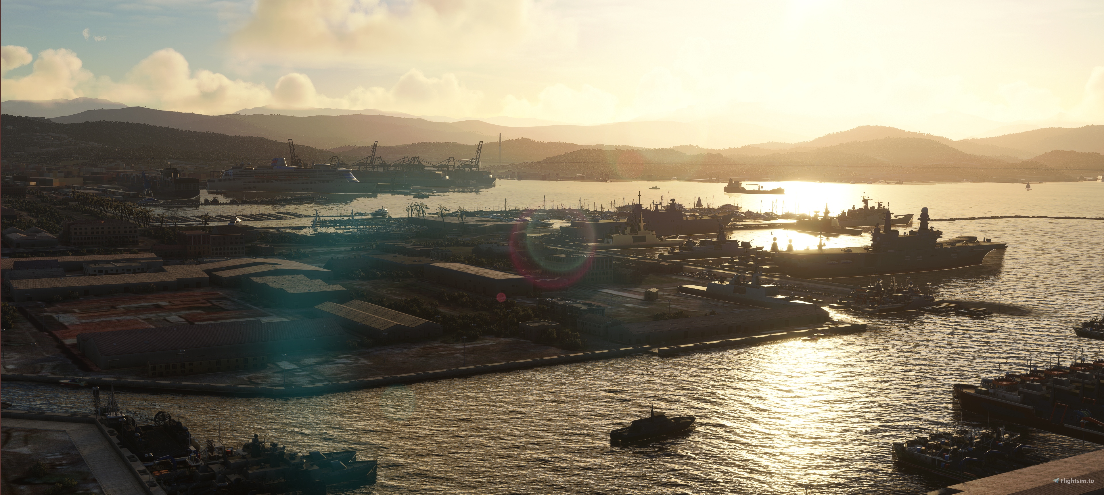
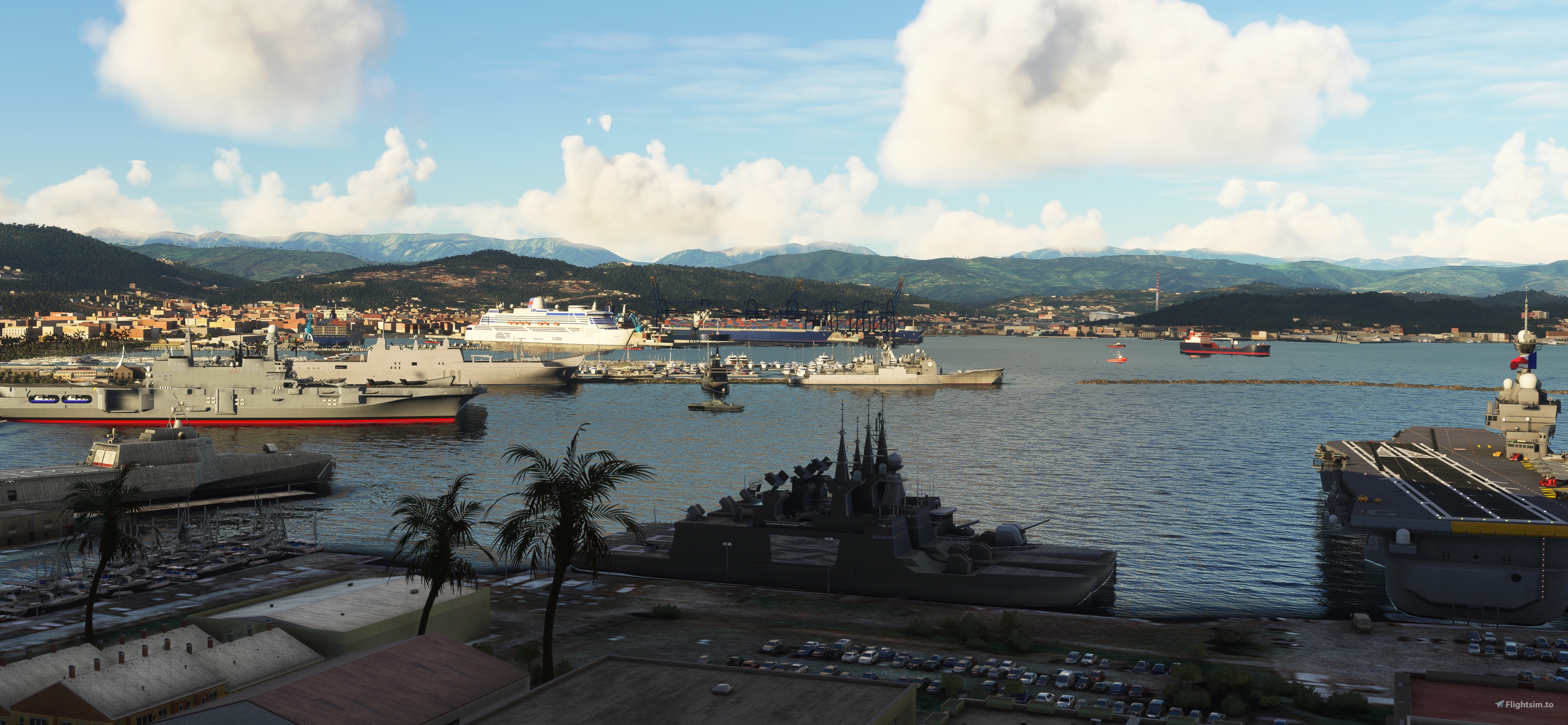
La Spezia. A Cavour and Charles de Gaulle in La Spezia naval yard. The yard has also been filled out with boats. ICAO - ACLS. Coordinates - 44.091390 9.830466
Sicily half way to Tunisia. A Cavour and Charles de Gaullle. ICAO - ACSM Coordinates- 37.212523 11.787013
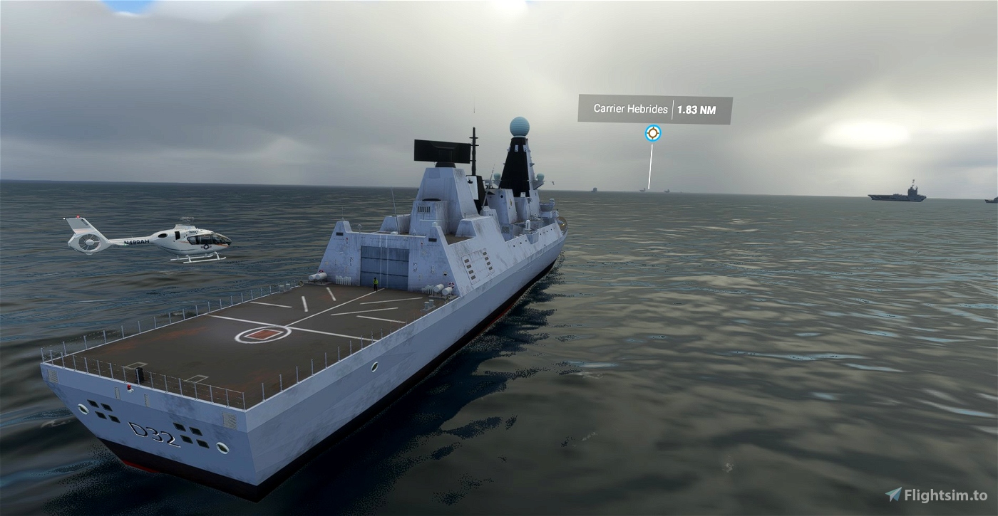
Outer Hebrides between Uist and St Kilda. ICAO - ACOH. Coordinates 57.689256 -8.042390
Africa
Cape Town. Close to shore with an approach over the hills. ICAO - ACCT. Coordinates - -33.947850, 18.341212
Lagos. I should've put this further out to sea. My arse hurts. So no. ICAO - ACLG. Coordinates - 6.390989, 3.426891
Casablanca. Too close AGAIN. It's late. ICAO - ACCB. Coordinates - 33.646526, -7.707354
Gulf of Suez. This is much more nautical. In the Red Sea about 120km from Suez. ICAO - ACSZ. Coordinates - 28.866822, 32.913080
Australasia/ Asia
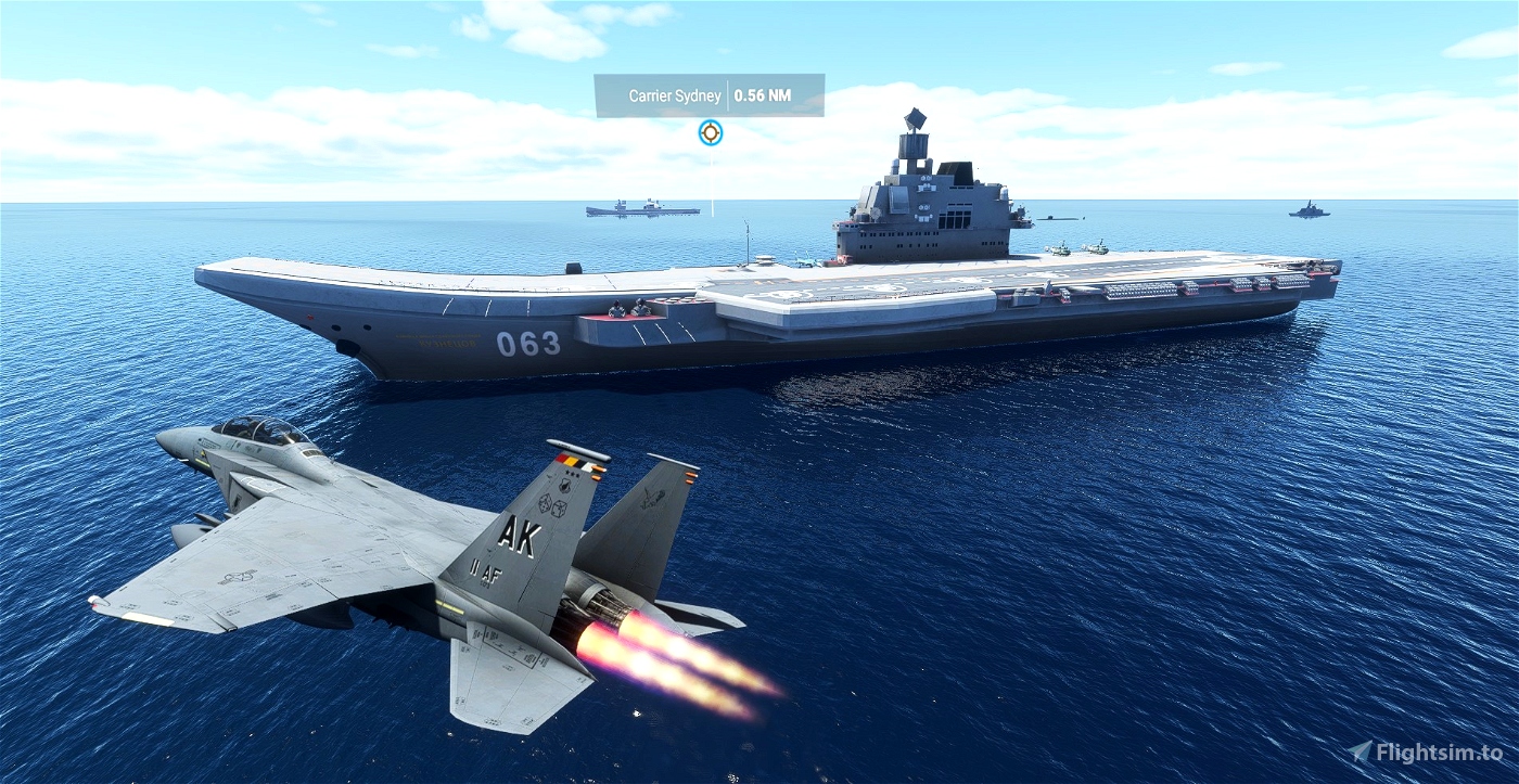
Sydney Just outside the harbour. ICAO - ACSY. Coordinates - -33.870341, 151.327391
New Zealand In the Cook Strait not too far from Wellington. ICAO - ACWN. Coordinates - -41.346701 174.450741
Black Sea Near Istanbul. ICAO - ACBS. Coordinates - 41.331980, 29.340734
Straits of Hormuz ICAO - ACHZ. Coordinates - 26.662936, 56.395895
North Korea A few miles from Wonsan. Best to get an Ambition Haircut before departing just in case. ICAO - ACNK. Coordinates - 39.269835, 128.655586
Vietnam
A USS Enterprise CVN 65 and USS Midway CVN 41 planted at Yankee Station 90 miles off the North Vietnamese coast. ICAO - ACYS. Coordinates - 17.499047, 108.500273
Hong Kong
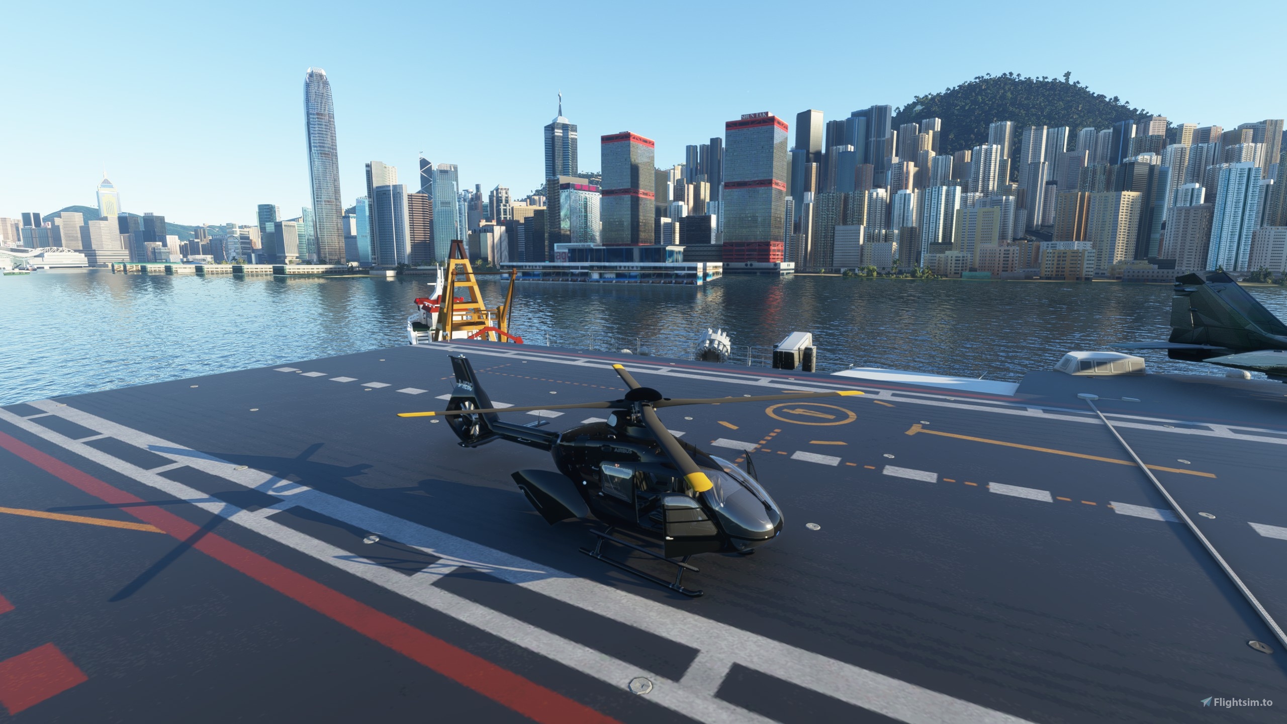
In the middle of town. Three carriers, the Liaoning and Shandong and a Kuznetsov. Ramp city. ICAO - ACHK. Coordinates - 22.293898 114.150829
I was so sickened by the state of the port at Hong Kong I've done an upgrade of the second carrier's surrounds here - https://flightsim.to/file/8424/port-of-hong-kong-upgrade
China/Taiwan
The Liaoning and Shandong in the Taiwan strait cos you feel like a bit of sabre rattling. ICAO - ACTW. Coordinates - 25.710148, 120.696830
Vietnam
Dixie Station. A lone USS Midway SE of Vietnam. ICAO - ACDS. Coordinates 10.994253 110.000096
Bahrain
The USS Midway and Dwight D Eisenhower in Gulf War guise off the coast of Bahrain. ICAO - ACGW. Coordinates 27.504030, 50.066442
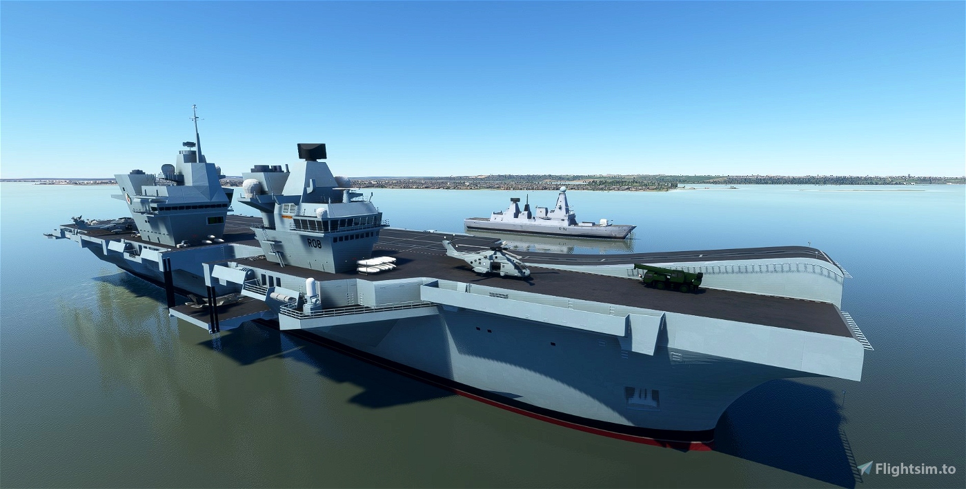
Yokohama
The USS Midway close to Yokohama. ICAO - ACYK. Coordinates - 35.448744, 139.745032
Oceans
Middle of the North Atlantic below Greenland. ICAO - ACAN. Coordinates - 59.387623, -33.654331. This is a lone US carrier with a fuel bay for your lengthy hopping.
Tristan da Cunha. ICAO - ACTC. Coordinates - -37.239954, -12.435205. The US carrier here also a fuel bay cos there really aren't too many other places to get some in that part of the world. Trust me.
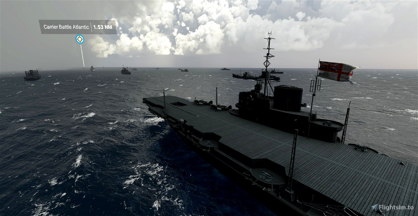
South of Iceland ICAO - ACBA. Coordinates - 59.517396 -19.760918 A WW2 Atlantic Convoy. You will be taking off from the HMS Illustrious which is runway 04, or the Ark Royal what is 05. There's also a dumb carrier somewhere in the middle that's landable but not an offical runway.
Antarctica ICAO - ACAC. Coordinates - -62.855206, -58.196414 A carrier group with a fuel bay in the Bransfield Strait.
Guam
A USS Enterprise and Midway near Guam. ICAO - ACGU. Coordinates - 13.799816 144.8693
Tahiti
The Charles de Gaulle, Mistral and Cavour near the main islands. Go, Europe. ICAO - ACTH. Coordinates - -17.382894, -150.025760

 superspud


Doesn't work
12 months ago
dandogbacon
the carriers show up but the planes cannot take off from them, they shut down
1 years ago
Or4ng3sky87
Fantastic mod, congrats!
Installed both Vol.1 and Vol.2 (both folders each, so including arrestor wires), but still not able to see the wires as well as stop the aircraft on the deck after touch down.
Do I need Kinetic assistant or arrestor wires and catapult launch should work wihtout?
Thanks
1 years ago
DenisFerrari
Thanks
https://youtu.be/SeVEtT0Dhfo
1 years ago
david_joe
Un grand Merci pour ce magnifique addon.
Il est très important de télécharger les trois fichiers et de le mettre dans le Community. Au départ je n'avais téléchargé que le fichier principal mais je n'avais pas de porte-avions seulement quelques textures. 😞
A big thanks for this splendid addon.
At the beginning I had only download the first files with these 2 folders 😞
1-aircraft carrier group volume 2 - superspud
2-aircraftcarriergroup2-arrestorwires
But I had all the position of aircraft carriers but without textures on only some off them
I understood when I am looking for DDS but nothing.
Sorry you have to think that I am a "noob" yes but I found my solution when I download thes othes files aircraft carrier group 3.8 - superspud_8pLkR and aircraft carrier group 3.8 Unstarred_8luKB
3-aircraft carrier group - superspud
What is the difference with Stars I am going to make the test?
But nevertheless all is perfect with new Sim Update 11
I am using also the F18 super Warrior
Merci beaucoup
Regards from France
1 years ago
Maclaw
Anyone know when this will be available again?
2 years ago
TheAussieGamer8
Mods no longer workin?
2 years ago
BlackFalco
Shows up in content manager but doesn't in game.
2 years ago
Same as the last person. It must have a problem then. Update in the works.
2 years ago
superspud
limeX
le mod ne fonctionne pas, j'ai bien mis le fichier dans l'onglet community comme tous les autres, mais au lancement du jeu, aucun des porte avions n'est présent sur la map. avez-vous une solution ?
2 years ago
There are two folders inside this download. So you will need to click on the folder again and paste those two folders inside it.
The folder names are 'aircraftcarriergroup-arrestorwires' and I can't remeber the other name, but it will be the folder next to it.
2 years ago
superspud
Traanche2Pain
is it SU9 compatible? please tag it if it is so. thanks
2 years ago
It's fine, but obviously the most important mod - the F/A-18 Super Warrior - is currently broken. I'm updating this at the moment.
2 years ago
superspud
flusiflo
Some beautiful ships Rear Sir Admiral Spud...I used your LHD and O.H.Perry Class in a 'Captain Phillips / Maersk Alabama / Somalia / Seal Team 6' video which mostly featured Henrik's Global AI ships (his channel won't accept comments sadly but I did credit him of course in the video). However as I brazenly borrowed 2 of your excellent ships in the same video I felt obliged to give thanks for your works of perfection too in the following YouTube video https://youtu.be/t8Y-8N1Dd6Y
PS thanks for the Old Man of Hoy.
2 years ago
Looking superb. I'm debating whether to wait on updating this on the extreme off chance the Top Gun mod adds moving carriers, but I have my sizeable doubts.
In the meantime the naval forces will have to remain strangely stationary.
2 years ago
superspud
wanchaibanzai
it does not work for me,both folders are in the community folder, when i type in carrier it doesnt show up, i tried it a couple of times and it still doesnt work, i even reinstalled msflight sim
2 years ago
ijeezy1995
For me, it unfortunately doesn't work (since WU8). For ex., starting at LXBG, flight loads 40%, than stops. I have to kill MSFS via taskmanager.
Volume 2 seems to work.
2 years ago
Weird. All fine for me but I'm working on an update now so let's hope that makes it behave.
2 years ago
superspud
TBird66
Hi, for whatever reason my aircraft carriers are pink nodes. Any reason why this happened?
2 years ago
Delete completely and redownload.
2 years ago
superspud
Danoyam
It says its not compatible with sim update 8
2 years ago
Msfs2020Fan