
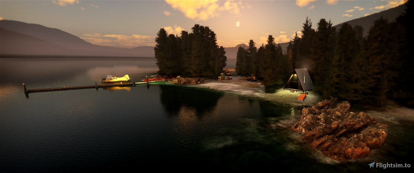
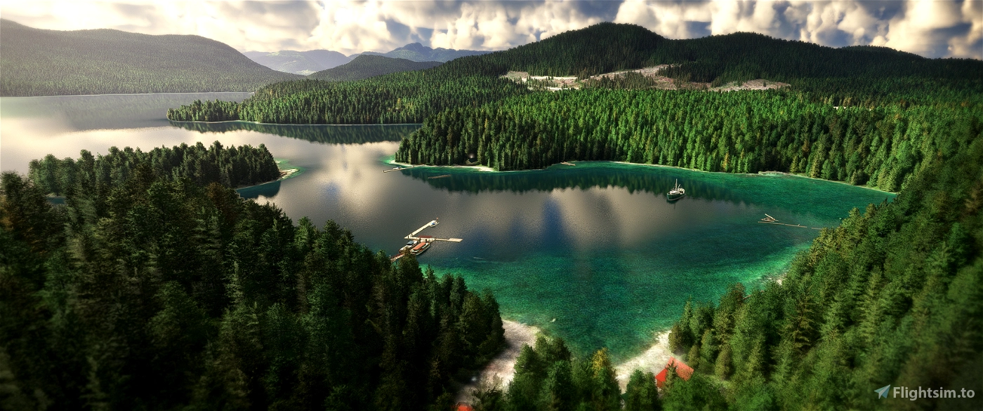
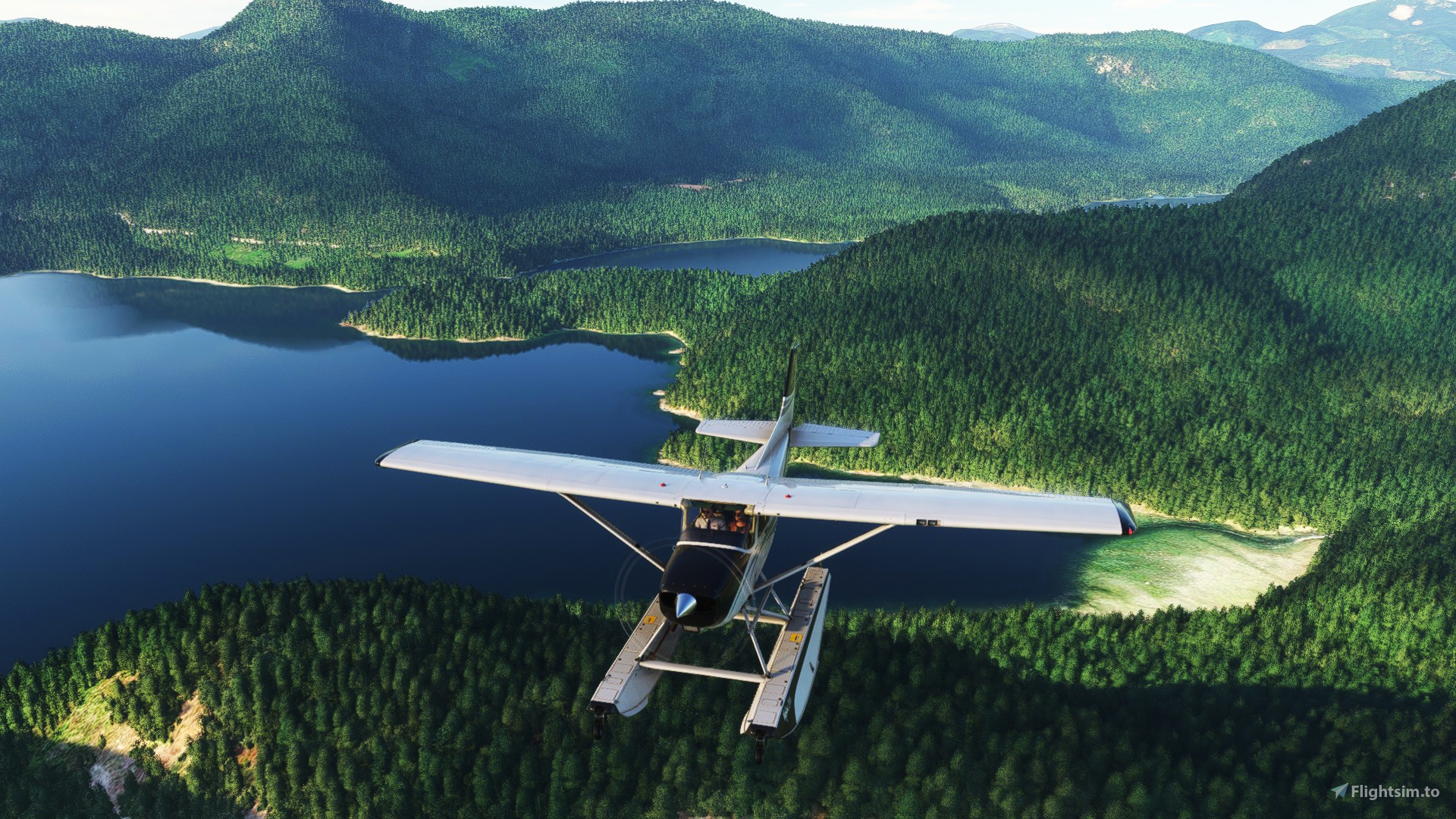
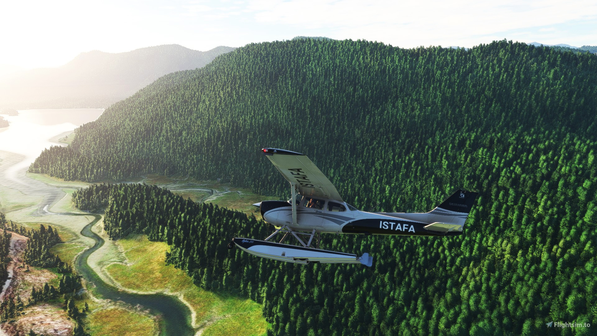
Fire up the radial engine and enjoy this roughly 500sq km immersive, primarily seaplane focused scenery.
Scenery: Before and after comparisons trailer
This project started off as a supporting scenery for my previous Port Harvey project, but it quickly evolved into a mammoth endeavor that took over 4 months and hundreds of hours, dwarfing Port Harvey in its scope.
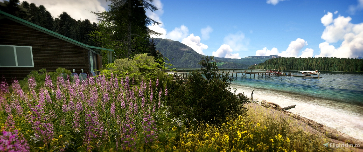
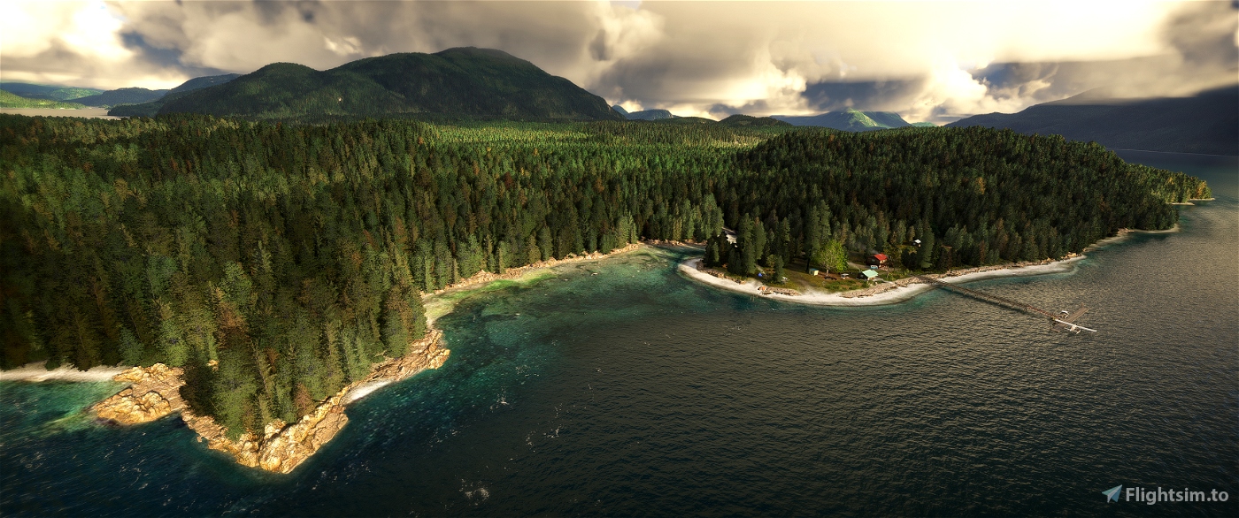
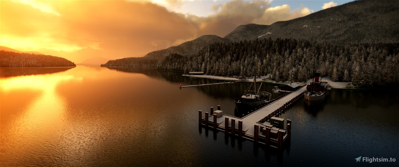
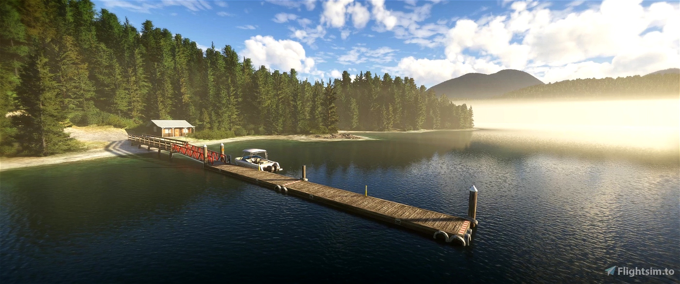
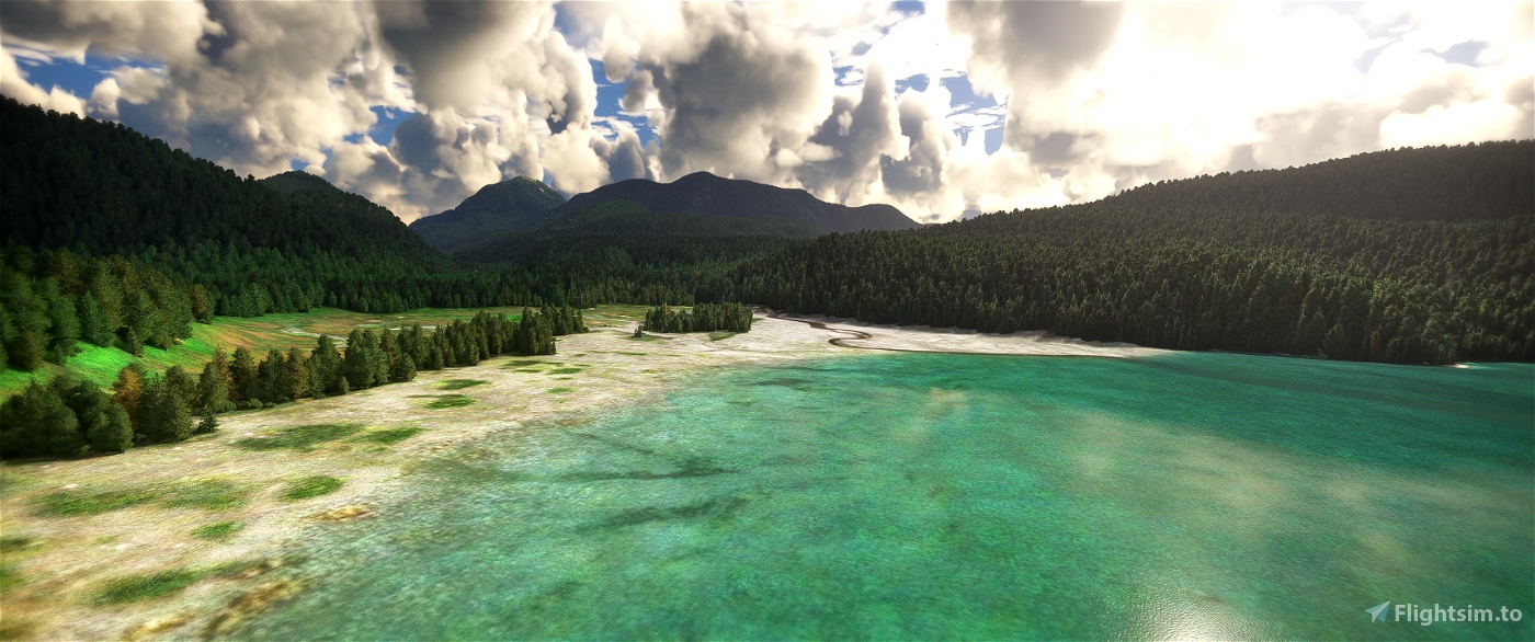
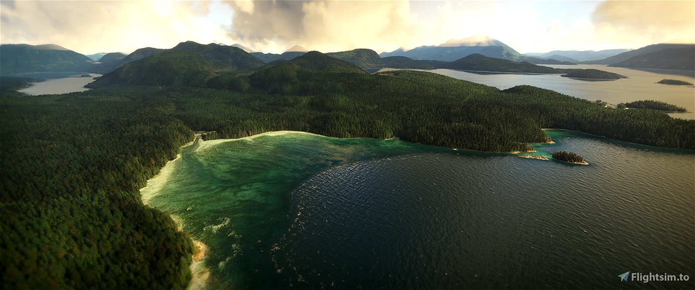
Port Neville & Beyond has many features encompassing roughly 500sq km of improvements and fixes. Alongside the central detailed Port Neville scenery, the main focus was to create a large, beautiful area where you can immerse yourself as a Canadian seaplane pilot in British Columbia. Embark on a mail-run between the 13 fleshed-out locations included, and say goodbye to the dreaded acid-green waterfall coastlines and other default MSFS2020 scenery quirks that so easily ruin immersion.
Please read requirements section to insure scenery works as intended
Main features:
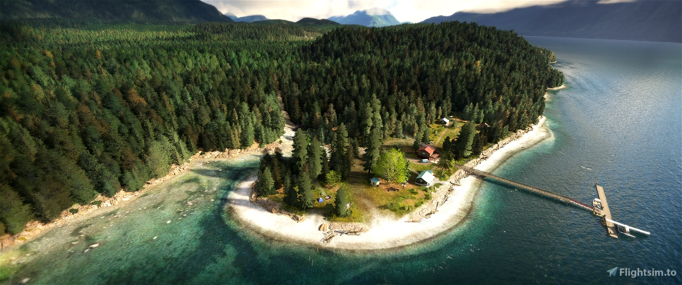
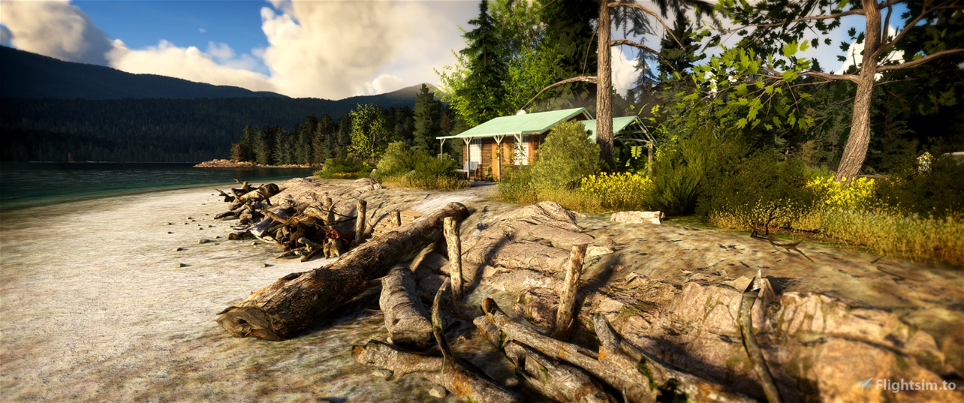
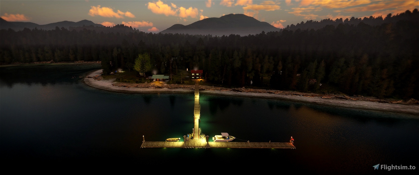
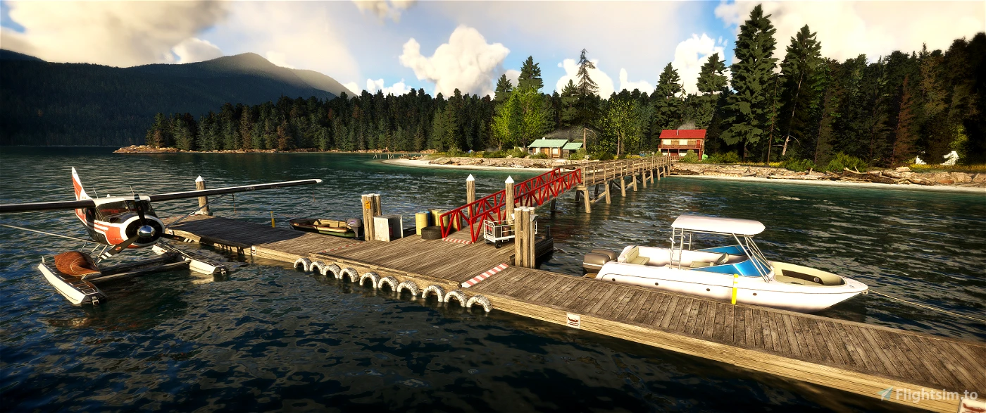
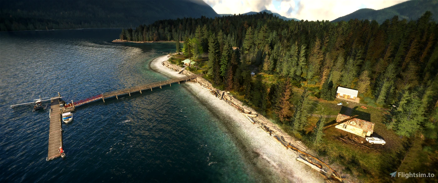
- The namesake Port Neville scenery*. Very strong focus on the small details. The coastline and landscape around this main scenery is especially detailed with many assets, texturing detail, and water masks.
(See airfield list further down to get a full breakdown of things like runways, helipads etc)
- 12 supplementary “airfields”, including a total of 4 official STOL runways.
All have been added to the world map with unique ICAO codes. This implementation means they can appear in software like Neofly (see Neofly implementation tutorial further down).
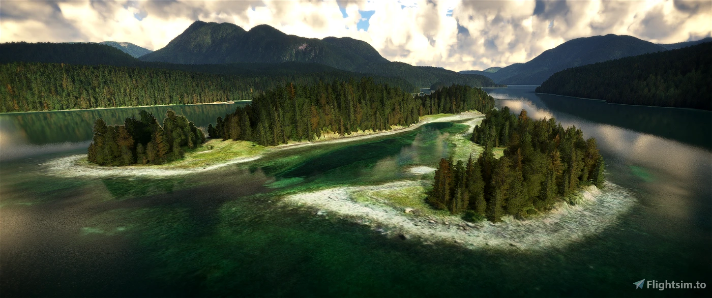
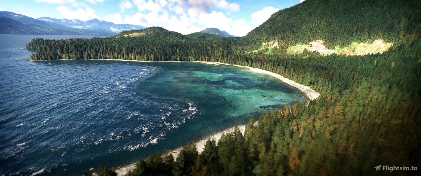
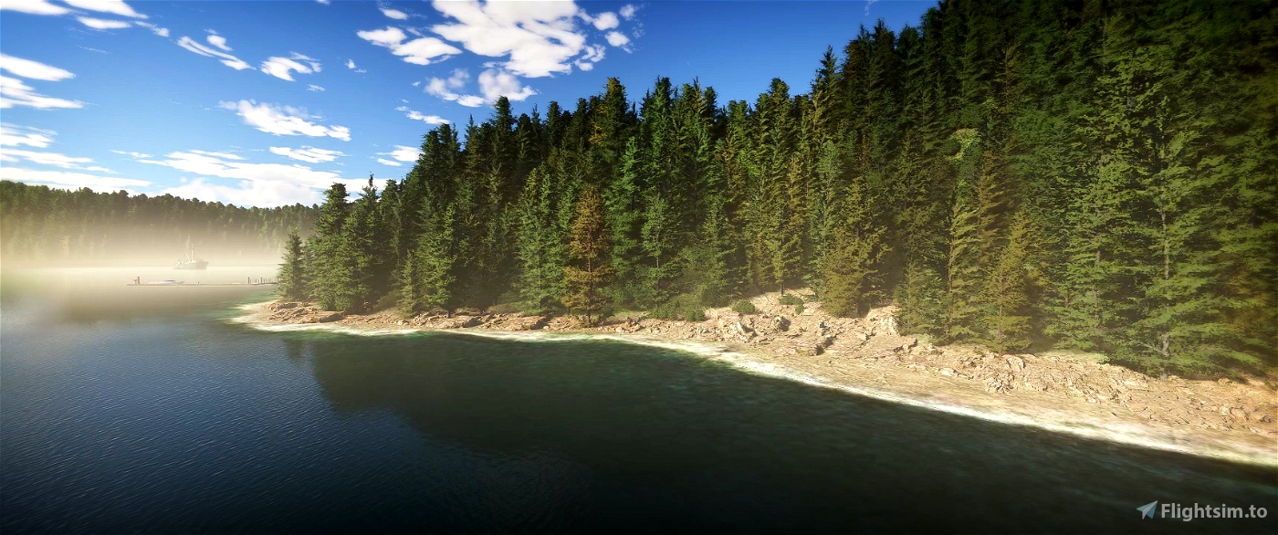
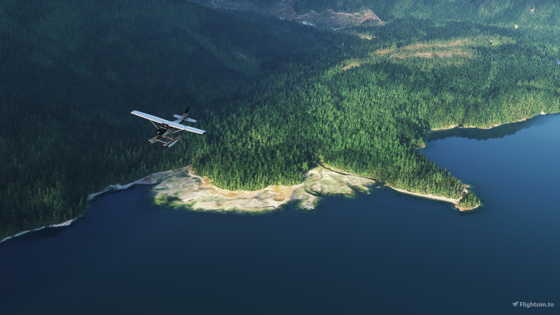
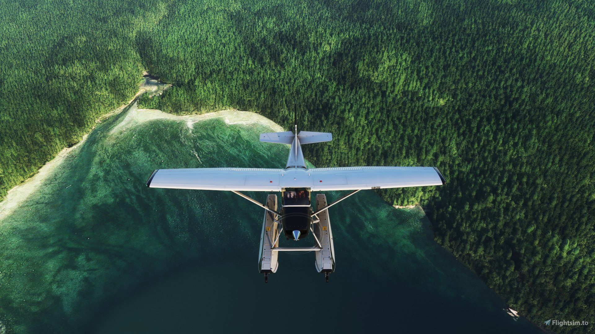
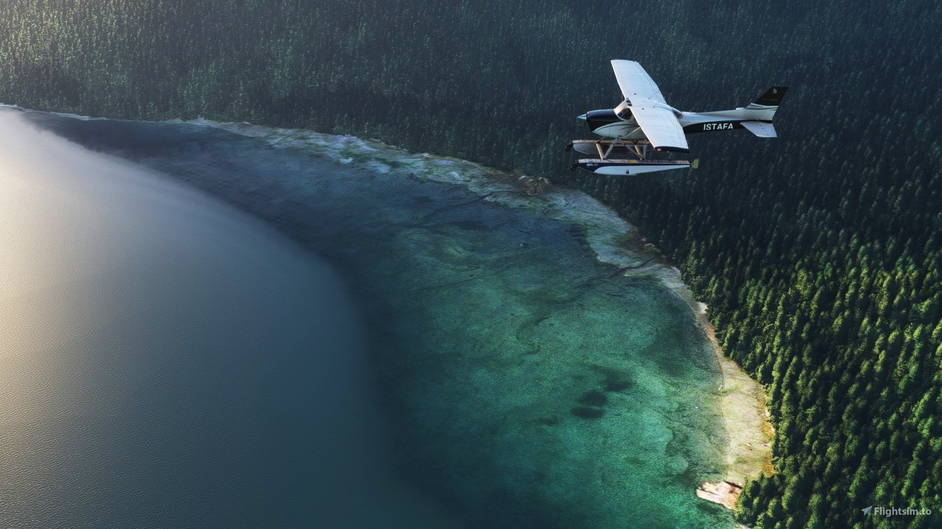
- Roughly 500sq km of fixes/improvements to the coastline/terrain, vegetation, textures, and water. This also includes about 90 lakes which were either missing or very bugged.
These changes, in conjunction with the new supplementary “airfields” (of which the surrounding scenery has been improved with even greater detail) result in a substantial area where you can happily fly with full immersion. This was a huge undertaking but ideally most of my tedious labour will be unnoticed as the changes will feel natural.
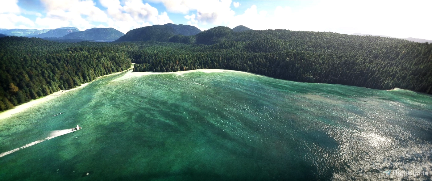
- 9 areas with watermasks**.
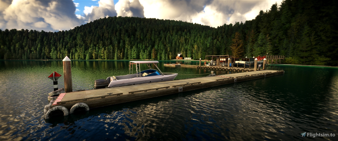
- All pontoons/docks added have custom collisions to help avoid issues of planes jumping on top of them.
- Built to work in perfect harmony with my previous scenery, Port Harvey. Seamless transition between the two sceneries.
* This is not meant to be a true-to-life recreation. I took strong inspiration from the actual Port Neville and surrounding area, but ultimately I went with what I thought worked best for form and function.
**My method tricks the sim to make a large area into transparent shallow water, like you see right at the edge of the default water. It’s not perfect in certain wind and lighting conditions but I’m very happy with how it turned out. The other thing to be aware of is an unavoidable issue which causes some planes to get stuck in patches due to a quirk of how MSFS treats shallow water. The DHC-2 Beaver works perfectly though! And of course, being the patriotic Canadian bush/float pilot you are, the Beaver should be your number one plane of choice ;)
Some quality limitations to please keep in mind:
- Things like terrain, water, textures and vegetation inside MSFS can be extremely stubborn and random at times. So even though I made things as detailed as possible, there will unfortunately be the occasional issue. For example; the waterline might not be perfectly matched to the waterline image or there may be some trees very close to water lines.
- The SDK and the exported files don't match up perfectly (sometimes significantly), so if you see small slithers of blue that are not covered by water, or other similar issues, please take into consideration that it's likely MSFS at fault and not my own negligence!
- Most of the year one side of the hills are in constant shadow, which is represented in the Bing image data. Due to the complications this creates, I have often put less detail and time into these areas.
- Bing map images are overexposed which can look odd at times against models at correct exposure. I've blended textures in many cases to reduce this, but again as mentioned above, these textures can have a mind of their own!
Cold & dark parking guide:
Dock parking 1-3: These parking spots are offset by increasing distances so that most aircraft can sit snugly against the pontoons. Use these parking numbers as a size guide:
1 = Small aircraft, such as the Husky A-1C
2 = Medium aircraft, such as the DHC-2 Beaver
3 = Large aircraft, such as the Junkers JU52
STOL airstrip parking = 4
Helipad parking = 5. There is also a hot start option which is displayed as a helipad icon on the world map. If you want to do a cold start make sure to hover over this icon until you see the number 5 parking spot appear from beneath it.
Requirements:
3rd-party addons:
Please go share the love and leave a high rating on these pages after you have downloaded. This project could never have been accomplished without their work.
- Seaplane Asset Library
https://flightsim.to/file/32010/seaplane-asset
Thanks 30West
- Emerald Object Library
https://flightsim.to/file/8824/emerald-object-library
https://emeraldscenerydesign.com/products/eolib-msfs/
Many thanks to Emerald Scenery Design. You can check them out at https://emeraldscenerydesign.com/
- Ethnicfs Vegetation library
https://flightsim.to/file/56359/ethnicfs-vegetation-library
Thanks ethnicfs
- MSFS 2020 object library
Thanks colinj
World updates:
(make sure you have all the airports and POI)
Please note: Port Neville & Beyond and Port Harvey have slightly different requirements.
World Update XI: Canada
World Update XII: New Zealand
World Update II: USA
World Update X: USA
-World Update III: United Kingdom & Ireland (only “EG78 - Out Skerries”, and “UK - Points of Interest” should be needed)
Other airfields:
Some of the night lighting requires european airfields, which appear to be vanilla airfields but available in the profile -> content manager. So make sure the following airfields in the content manager are installed:
EDVK
EDJA
EDDP
Strongly recommended, almost essential addons:
- Rex Accuseasons.
If I could make this a mandatory requirement I would since it changes the feel of the sim so drastically. It is payware but I highly recommend it. I built this scenery to work alongside it.
For best results, and what I was working with, I recommend these settings:
Vegetation Color Tones: Neutral colors
Resilient Vegetation Color Tones: Standard colors
Vegetation Height: Short height
Deciduous Canopy Type: Irregular type
Seasonal vegetation preset: Farewell To Summer
Seasonal terrain coloring: None
- Toolbar Pushback
https://flightsim.to/file/15033/toolbar-pushback
If you’re using float planes then you absolutely need this mod! Simply set the tow speed to 0, assign a pushback key to your setup, then you can hold your plane in position at the dock to simulate being tied down. You can even use it for pushback if you’d like and it has many great features.
- GotFriends 40th Anniversary Expansion
Greatly improves the Beaver
Performance and feedback:
Apart from understandable increased loading times, I personally have no issues with performance on my rig, but please let me know in the comments if you do and I can potentially look into making a lite, performance friendly version.
If you notice anything that doesn't look right, or any bugs then please let me know. The SDK is pretty annoying at introducing new issues while exporting.
Compatibility:
This will almost certainly have issues with any 3rd party software that changes the height maps in this area.
I have added exclusion rectangles over all the airfields so you can safely use mods like Mamudesign - Marinas. Having added these exclusion rectangles over only the airfields also means you can add your own scenery over top of mine if you want.
Airfield list:
These location backstories/explanations are mostly fictional.
Hot starts + cold and dark parking available for everything specified below.
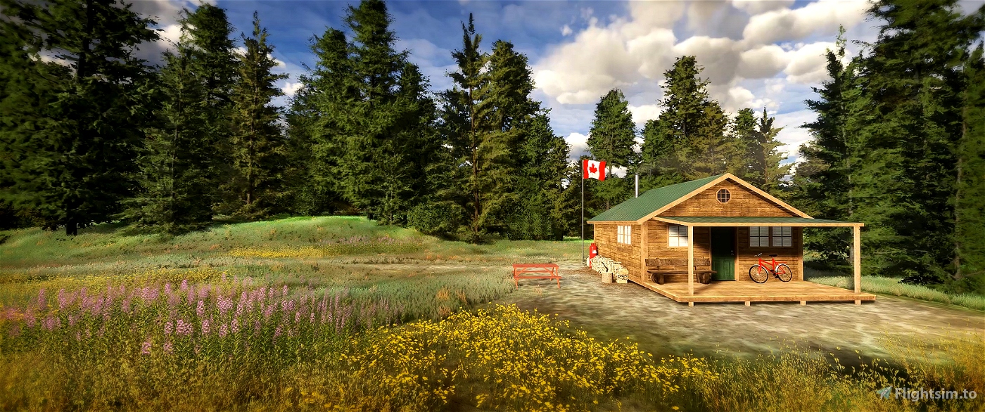
Port Neville
ICAO: PNBC
STOL airstrip: 380m grass, unmarked
Helipad: Grass, marked
Seaplane: Pontoons
Due to popular demand, Port Neville’s post office (which was closed in 2013), is back up and running. Once again this port has become the central hub for airmail deliveries in the area. Even while the post office was out of action the port maintained a steady influx of tourists and became a popular site to visit or stay.
A recent storm which directly hit the nearby Port Harvey didn't completly spare Port Neville. A historic cabin fell victim to a fallen tree in the strong winds, but apart from that, the steadfast staff have quickly set the port back to normal operations.
McLeod Bay
ICAO: 01BC
Helipad: Gravel, unmarked
Seaplane: Small pier
This cozy cove offers refuge from the sometimes perilous conditions in Johnstone Strait.
Blenkinsop Bay
ICAO: 02BC
Helipad: Gravel, unmarked
Seaplane: Small pier
Situated high on the steep ridges overlooking Blenkinsop Bay, this cabin is an enticing property for visitors to book. Whether it's for the stunning views of the bay, or being a prime location for hunting excursions, visting this secluded bay is high on many people's wishlist.
Robbers Nob
ICAO: 03BC
Helipad: Gravel, unmarked
Seaplane: Pontoons
Just around the corner from Port Neville is Robbers Nob. From this usually tranquil site reverberates the sound of construction as a new property poised to take in the sights of the surrounding landscape is built.
Mount Collingwood Port
ICAO: 04BC
Helipad: Gravel, unmarked
Seaplane: Pontoons
A busy port, and central hub for forestry in the area. Substantial dock facilities at this location make it a popular stop for tours, including a historic cruise ship. The port hosts a sizeable and bustling Café/general store that many in the wider area often frequent.
Fulmore River
ICAO: 05BC
STOL airstrip: 184m grass, unmarked
Helipad: Grass, unmarked
Seaplane: Beach
This is a popular spot for fishing tours, even though the best fish are often scooped up by the local wildlife. The small grass field makes this an enjoyable, but challenging stop for bush pilots.
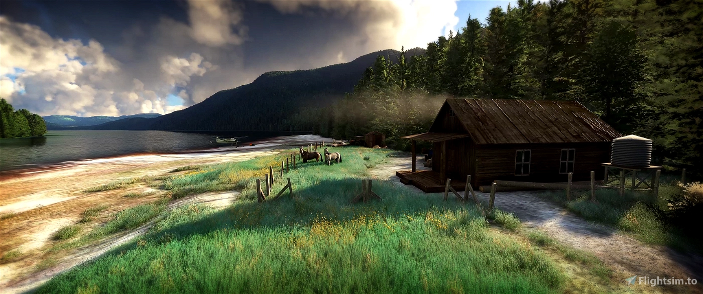
Fulmore Lake
ICAO: 06BC
Helipad: Grass, unmarked
Seaplane: Beach
To the western edge of this substantial lake resides an iconic local character. Always up for a yarn he'll often either have visitors or be off on his horse to catch up with the distant neighbours.
A very rustic location that casts one's mind back to times gone by.
Port Squire
ICAO: 07BC
STOL airstrip: 470m gravel
Helipad: Gravel, unmarked
Seaplane: Beach
Forestry is a big deal in this neck of the woods. To support the industry's demand around Call Inlet, a large port and settlement dedicated to Forestry infrastructure is at the start of construction. A bush airstrip has been cleared to help with the logistics.
Snow Mountain Lookout
ICAO: 08BC
Helipad: Grass, unmarked
Seaplane: Pier
A fire lookout tower keeps a vigilant gaze on the surrounding area atop this majestic mountain.
The lakes at the summit offer convenient access to floatplanes.
Burial Cove
ICAO: 09BC
Helipad: Pontoon, marked
Seaplane: Pontoons
Being a relatively populated area, this bay hosts substantial dock infrastructure including a pontoon helipad. Many local fisherman call this place home, often mooring their ships in the sheltered cove.
Hadley Bay
ICAO: 10BC
Helipad: Gravel, unmarked
Seaplane: Pontoons
This small settlement houses a talented mechanic and his large boatshed workshop. Most marine craft in the wider area set sail for this location when in need maintenance.
Bowers Island
ICAO: 11BC
STOL airstrip: 270m grass, unmarked
Helipad: Grass, unmarked
Seaplane: Pontoons
This large, mostly flat island offers an ideal gathering point for bush pilots. Many end up making camp, relishing the serenity that the island's meadows offer.
Cutter Cove
ICAO: 12BC
Helipad: Gravel, unmarked
Seaplane: Beach
This picturesque cove is a treat for the eyes, but there's something in your gut that evokes an unexplained sense of dread when visting. Fortunately, due to the cove hosting just one elusive resident, deliveries are rare.
Neofly tutorial
To get the airfields working in Neofly, follow these steps.
1. Check the scenery is working as intended
2. Inside your Neofly folder, copy the navdata.sqlite file to a a backup location
3. Open Sky4Sim. Then click “Open Sky4Sim Pad in your web browser”
4. Head to the Navdata update tab. Then click update. Once done this will create a new navdata.sqlite file in your Sky4Sim NG folder.
5. Copy this new file into the Neofly folder to replace the existing one we backed up.
Good to go :)
Please don’t forget to rate this scenery. This took a huge amount of time to create and I would hate to see it get lost in the abyss of add-ons. I’m kind of keen to keep heading South-East in a new project but need to justify that commitment knowing there is a demand for it.
Happy flying :)


I will try your "Port Harvey" Mod 😉
Take Care & Fly Safe.
20 days ago
WRATH
1 months ago
Djeez2
1 months ago
BurstixTV
1 months ago
NismogtrPhil
I still think I have to tweak as I have most of my files using the wonderful MSFS Addon Linker (Canada files in Canada folder , USA with USA folder etc. including official world updates) but this scenery is 1st Class.
Minor - I do have a boat come motoring through me before I even start at McLeod Bay, which then sales through the beach behind me!
1 months ago
1 months ago
maty743
Dexdoggy
1 months ago
liojac
1 months ago
1 months ago
maty743
Chandy
1 months ago
Westcoaster
1 months ago
dpskg1993
1 months ago
Enigmaau
1 months ago
Sky173
1 months ago
wingboss
1 months ago
LobsterDude
1 months ago
pekke74
Thanks again for all the positive feedback, really makes it all worth while knowing so many people are enjoying it.
Cheers
2 months ago
maty743