Description
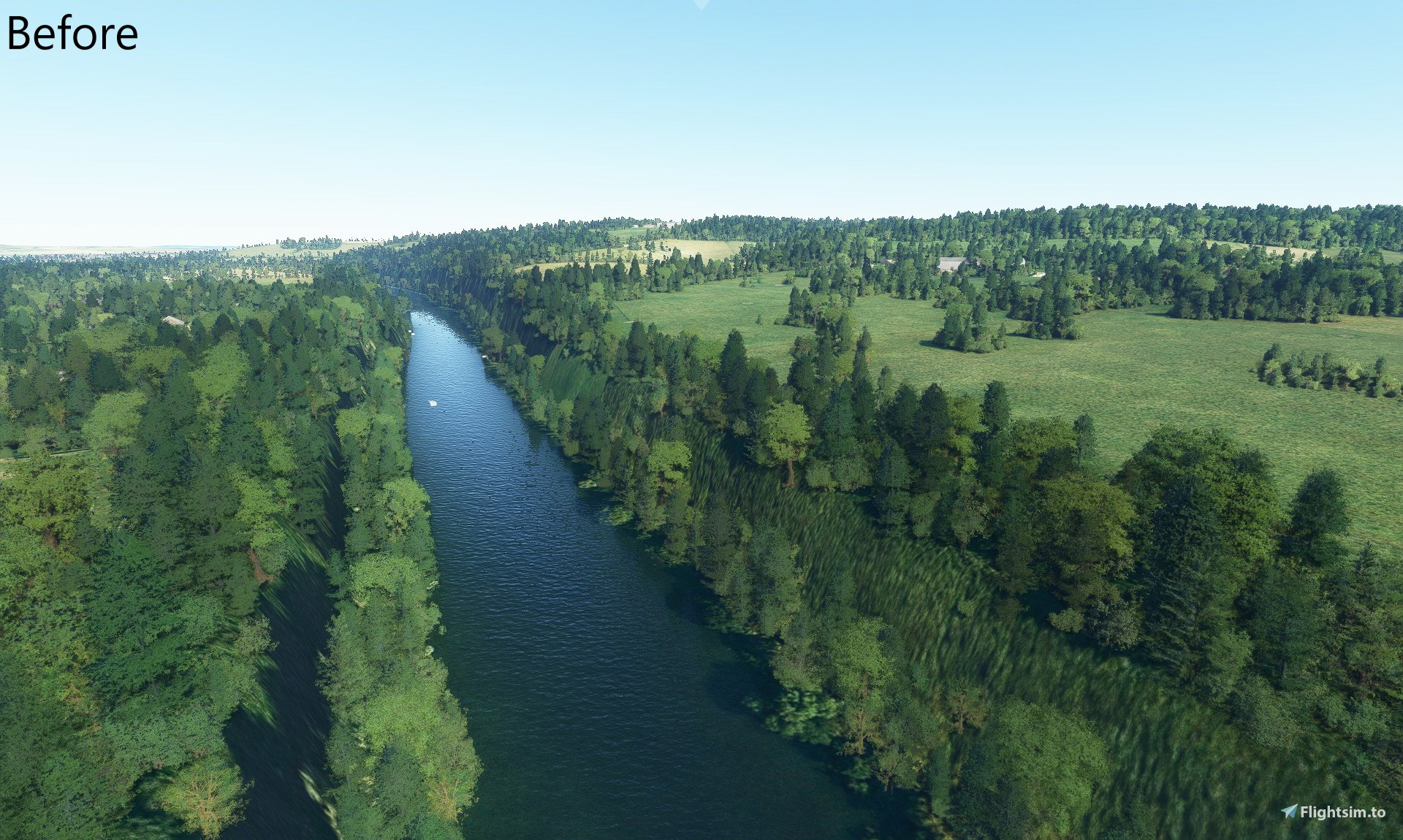
This package fixes elevation issues with rivers across the UK, causing them to be in huge ravines due to elevation data issues. These issues were caused by the UK world update, and therefore the package is only required if you are using this update.
Rivers Fixed:
- River Thames between Goring and Wargrave
- River Kennet around Hungerford
If you find other rivers in the UK with similar issues, let me know and I'll take a look!
Questions fréquemment posées
Commentaires(19)
Connectez-vous pour participer à la discussion
Se connecterabout 4 years ago
Thanks for this it makes a huge improvement to the sim in the UK, especially around Reading. I only just stumbled upon this fix even though it has been around for over a year. Wish I had discovered it sooner lol.
Confirmed working with SU9
about 5 years ago
about 5 years ago
about 5 years ago
about 5 years ago
about 5 years ago
about 5 years ago
about 5 years ago
about 5 years ago
about 5 years ago
about 5 years ago
about 5 years ago
about 5 years ago
about 5 years ago
about 5 years ago
I fix the elevation issues by creating polygons at the level of the terrain surrounding the ravine, and bringing the terrain inside these polygons up to that height
about 5 years ago
about 5 years ago
about 5 years ago
UK River Elevation Fixes
Fix elevation issues on UK rivers affected by the UK World Update, preventing huge ravines in the landscape. Current fixes include River Thames and River Kennet areas. Notify the developer for additional areas with similar problems.

Avis des utilisateurs
4 avis
Location
More Information
Historique des versions
Minor title change in content manager
Similaires

Swiss mountains tree fix (trees on mountains removed)
A comprehensive mod fixing tree placement on Swiss mountains, particularly removing inaccurately placed trees on mountain peaks. The update includes a shift to more realistic conifer trees in the Alps and an expansion to border areas of France, Italy, and Austria. From Alpstein Säntis to Stockhorn, numerous locations across Switzerland have been meticulously corrected for a more authentic flight experience.
par THEOLI4D

Shorter Trees / Tree Height Modification VERSION 4.0 for MFS2020 (shorter, realistic trees)
Experience realistic and shorter trees in Microsoft Flight Simulator with the Shorter Trees / Tree Height Modification VERSION 4.0 add-on. Compatible with the latest version of MSFS, this mod provides adjusted tree heights for a more authentic flying experience. Update includes enhanced tree coloration blending seamlessly with photogrammetry trees. Installation is simple - just copy the folder into your community folder and enjoy a new perspective from the skies.
par ARIF STUDIOS - Adnan Arif

AUSTRIA 10m DEM - High Resolution Terrain Elevation Data from LIDAR Imaging
Explore the stunning terrain of Austria with this mod featuring high-resolution LIDAR data, offering a mesh resolution of 10m for a more realistic flight experience. Flatten lakes, rivers, and eliminate any terrain artifacts as you soar over the Austrian landscape. Divided into regions for convenience and performance optimization, this mod enhances the mountain shapes to mirror reality and provides a smoother flying experience. Experience Austria like never before with enhanced elevation data and realistic terrains.
par Troglodytus

SWITZERLAND 20m DEM - High Resolution Terrain Elevation Data from LIDAR Imaging
Explore the beauty of Switzerland with this mod offering high resolution terrain elevation data using LIDAR imaging. The mesh resolution is 20m, providing exceptional detail with a height resolution of 0.1m. Update includes extreme LIDAR meshes for specific regions. Please note potential performance impacts and report any bugs for further improvements. Fly VFR over Switzerland with enhanced realism and accuracy.
par Troglodytus
over 2 years ago
https://forums.flightsimulator.com/t/elevation-river-issue-in-london-near-heathrow-egll/482979