
Description
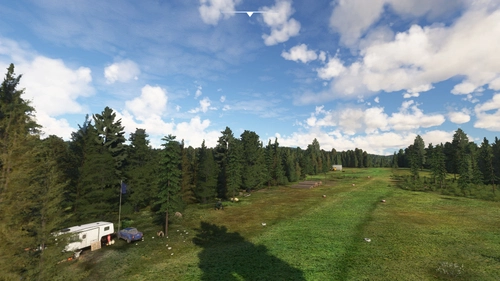
Quatam River and Moh Creek Airfields , Canada
Quatam River and Moh Creek airfield are small airfields in the mountains of British Columbia, Canada, located in a series of fjords and arms so although ocean water is just off the runway it is a long journey to the open sea. The airfields are just meters from the Quatam River which leads up a long valley and into the tall mountains. It is a hub for forest workers who are clearing out the forest up and down the valley sides. They have been there for more than 35 years serving many purposes.
Airport Name Quatam River Airport
ICAO Code CA-0302
Location GPS 50.384796, -124.942464
Elevation 115 ft AMSL (35m)
Airport Name Moh Creek Airport
ICAO Code CA-0240
Location GPS 50.524996, -125.052933
Elevation 577 ft AMSL (176m)
powel watchtower (GPS 50.454424, -124.999585)
deep valley climbing camp (GPS 50.411752, -124.812346)
medical unit helipad (GPS 50.392790, -124.877730)
note:
------
due to MSFS airport name limitation to 5 letters/digits
airports have been renamed and they will appear on MSFS map as C0302 and C0240
v1.0
airport completely made from scratch (missing in MSFS)
Uneven/Sloped Runways
airport at the right elevation
added some buildings
added various objects
some terraforming
added vegetation area
added windsock
creation of powel watchtower ,deep valley climbing camp, medical unit helipad
buildings and various objects (windsock, cars...)
remove water on shore west of runway
v1.2
fix airfields elevation to the right altitude
v1.3
fix airfields elevation since last sim update
fix sloped and uneven runways
v1.6
issue with files solve
various fix reported by users
Commentaires(27)
Connectez-vous pour participer à la discussion
Se connecterover 1 year ago
about 2 years ago
UPDATE!
Re downloaded and installed works perfectly
about 2 years ago
Cheers,
Steve
about 2 years ago
about 2 years ago
now you all have the right files Quatam River CA-0302 and Moh Creek CA-0240 Airfields
besr regards
about 2 years ago
Cheers,
Steve
about 2 years ago
about 2 years ago
it has just been corrected
thanks for reporting
about 2 years ago
about 2 years ago
about 2 years ago
about 2 years ago
about 2 years ago
about 2 years ago
about 2 years ago
about 2 years ago
I suggest you may use :
https://flightsim.to/file/392/tree-height-modification-for-mfs2020-shorter-realistic-trees
about 2 years ago
about 2 years ago
about 2 years ago
Quatam River airport and Moh Creek Airport
Explore the remote Quatam River and Moh Creek Airfields in the picturesque mountains of British Columbia, Canada. These small airfields serve as hubs for forest workers and offer challenging landings with uneven/sloped runways. Discover the unique scenery and detailed recreations of surrounding landmarks such as the powel watchtower and deep valley climbing camp. Get ready for an immersive bush flying experience in this stunning Canadian wilderness setting.

Avis des utilisateurs
4 avis
Location
More Information
Historique des versions
Similaires
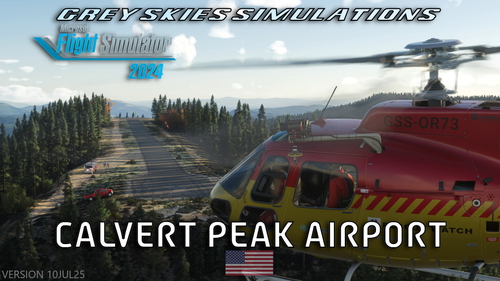
Calvert Peak Airport, Oregon (OR73) + SAR mission
Dangerous high elevation emergency & fire fighting airstrip for MSFS 2024 and 2020. A Search and Rescue mission is included. Paved runway, 1680 x 33 feet. Helicopter and water starts. Custom aerial imagery and models. Points of interests, wildlife and easter eggs.
par Grey Skies Simulations
Dali Fengyi Airport
Experience the beauty of Dali Fengyi Airport (DLU/ZPDL) in Yunnan, China. This 4C domestic airport, located at an elevation of 2155m, features modern facilities such as two terminals, seven airbridges, and 17 aircraft parking positions. Explore this regions rich history and stunning landscapes through this detailed add-on.
par AdamYao
Diqing Shangri-La Airport
Diqing Shangri-La Airport (IATA: DIG, ICAO: ZPDQ) is a civil airport situated in Yunnan Province, China, near Shangri-La City. Opened in 1999 and renamed in 2002, the airport spans 2,543 acres and features a 3,600-meter runway suitable for aircraft up to Boeing 757. It includes a terminal area of 3,073 square meters and offers 4 parking stands, located just 5 kilometers from Zhongdian County.
par AdamYao
Shump Alaska AA00
Explore the remote Alaskan backcountry with Shump Alaska AA00 - a hand-crafted airstrip offering a picturesque stop along your journey. This unique add-on features dynamic puddles, butterflies, bears, and even rusty cars to interact with. Compatible with the Emerald Scenerys library pack for an immersive experience.
par TC_Creations
about 2 years ago
Looks great otherwise. Great improvement.
Cheers,
Steve