
Description
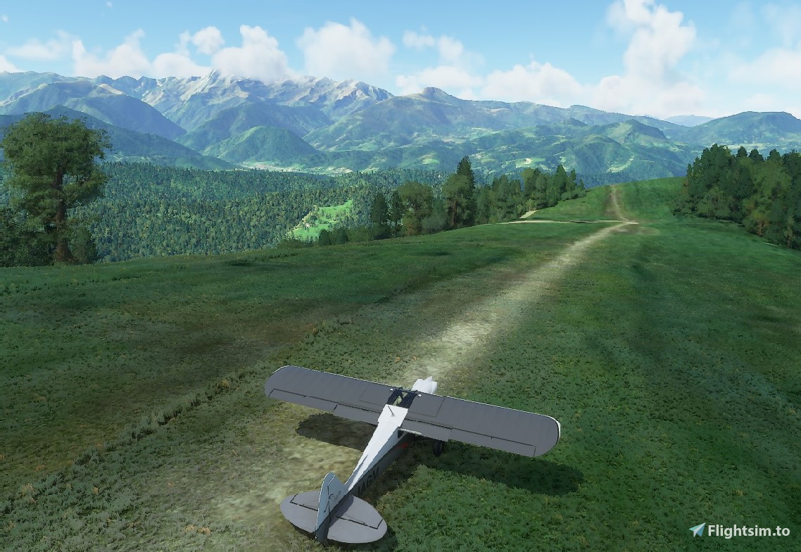
This is a custom bush trip around the Pyrenees mountain range. Expect plenty of mountains, forests, rivers and valleys. There's a couple of somewhat challenging airstrips, but other than that it's a walk in the park; a gigantic and wild park.
The route has 8 legs and can be completed in around three hours. It crosses the frontiers between France, Spain and Andorra several times while going up and down the mountain range.
I'm very grateful to the user lithilium for his great contribution, and also to f99mlu for providing the source files I used for my route (Scania Bush Trip).
Installation:Unzip the 'pyreneesbush' folder into your Community folder.
The route has 8 legs and can be completed in around three hours. It crosses the frontiers between France, Spain and Andorra several times while going up and down the mountain range.
I'm very grateful to the user lithilium for his great contribution, and also to f99mlu for providing the source files I used for my route (Scania Bush Trip).
Installation:Unzip the 'pyreneesbush' folder into your Community folder.
MSFS 2020MSFS 2024
Pyrenees Bush Trip
Embark on a scenic journey with the Pyrenees Bush Trip, a custom expedition around the majestic Pyrenees mountain range. This adventure features 8 legs crossing borders between France, Spain, and Andorra, showcasing diverse landscapes including mountains, forests, rivers, and valleys. Explore challenging airstrips and take in the beauty of this wild park-like setting. Just unzip the pyreneesbush folder into your Community folder to get started.
Téléchargements3K
Version1.0
Taille du fichier5.91 MB
PubliéIl y a 5 ans
Mis à jourIl y a 5 ans


Avis des utilisateurs
4.8
28 avis
5
82%
4
7%
3
0%
2
4%
1
0%
Historique des versions
Aucun historique de version disponible.
Connectez-vous pour participer à la discussion
Se connecterCommentaires(45)
about 1 year ago
over 1 year ago
Le seul bémol qui n'en est finalement pas tellement un, est quelques temps d étape un peu faussé, plus long qu'indiqué, mais cela rajoute au plaisir des yeux donc on s'en contentera aisément , et avec un minimum de sérieux on retrouve "facilement" sa route. En un mot comme en deux : Bra-vo!!
over 1 year ago
about 4 years ago
Beats most of the official trips. Gorgeous scenery. But watch out for LFMB!
over 4 years ago
Superb. Magnific landscapes and some challenging landings
over 4 years ago
Really excellent. Lovely route and very clear directions. First bush tour I've done in VR and it was amazing.
almost 5 years ago
Bonjour,
Le BT crash sythématiquement au debut du 1 Er vol, , une idée ?
over 5 years ago
over 5 years ago
over 5 years ago
over 5 years ago
over 5 years ago
over 5 years ago
over 5 years ago
over 5 years ago
over 5 years ago
As said by Ellair, I recommend doing a last leg going back to the first airfield following the Oriège, Ariège, and Saurat rivers. The view is stunning, descending in the valley after passing the Porteille d'Orlu, and it adds a last challenging landing at LFSQ (download https://flightsim.to/file/5595/lfsq-altisurface-d-aleu-france !), pass over the terrain, then 30° left from the runway, and come back for a 20° up slope kiss landing !
Thanks a lot erafnaman for this !
over 5 years ago
over 5 years ago
Challenging landing and icy conditions add difficulties. Nice!!
over 5 years ago
As always, main challenge is giving enough nav directions in one short paragraph of text but with the help of LittleNavMaps .... ;)
over 5 years ago