Description
The aim is to eventually cover the whole of Snowdonia.
To install, just unzip to your 'Community folder' and enjoy.
Version 1.0 - Barmouth to Porthmadog
Version 1.10 - A few tweaks to Dolgellau and Cadir Idris areas
* BTW, if anyone could build me the Railway bridge in Barmouth for this scenery, that would be awesome! ;-)
Commentaires(21)
Connectez-vous pour participer à la discussion
Se connecterover 4 years ago
Thanks for this. I've only recently bought the sim and these seemingly modest fixes greatly enchance the experience. Much appreciated.
about 5 years ago
If anyone else notices the problem, please let me know. :-)
about 5 years ago
and thanks for this wonderfull fix.
My approach to the Mach Loop is now much more interesting.
Usually I start in EGOD, go to Barmouth, turn left, over Dolgellau to Cross Foxes Inn.
But now in Dolgellau all 3D Houses are gone. And I can safely say it´s due to your fix. Without it´s o.k.
Please have a look at this vid: https://www.youtube.com/watch?v=wxHvw5rG2Bw&t=410s
Would be great to have the houses back :-)
But again, thanxalot.
over 5 years ago
over 5 years ago
over 5 years ago
over 5 years ago
over 5 years ago
over 5 years ago
over 5 years ago
over 5 years ago
over 5 years ago
over 5 years ago
over 5 years ago
over 5 years ago
over 5 years ago
over 5 years ago
over 5 years ago
over 5 years ago
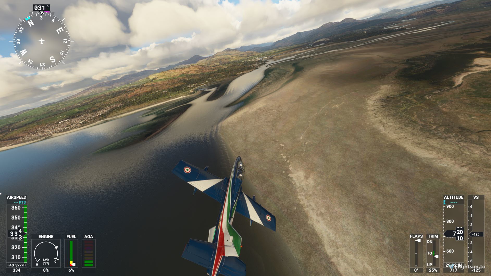
Snowdonia Coast and Rivers Fix V1.1
Enhance the realism of the Snowdonia national Park in Wales with this ongoing project. Reduce river and sea levels to create a more natural look and correct errors in the default scenery. This addon covers areas from Barmouth to Porthmadog with additional tweaks to Dolgellau and Cadir Idris regions in version 1.1. Simply unzip to your Community folder to enjoy the updates.

Avis des utilisateurs
3 avis
More Information
Historique des versions
Aucun historique de version disponible.
Similaires

Swiss mountains tree fix (trees on mountains removed)
A comprehensive mod fixing tree placement on Swiss mountains, particularly removing inaccurately placed trees on mountain peaks. The update includes a shift to more realistic conifer trees in the Alps and an expansion to border areas of France, Italy, and Austria. From Alpstein Säntis to Stockhorn, numerous locations across Switzerland have been meticulously corrected for a more authentic flight experience.
par THEOLI4D

Shorter Trees / Tree Height Modification VERSION 4.0 for MFS2020 (shorter, realistic trees)
Experience realistic and shorter trees in Microsoft Flight Simulator with the Shorter Trees / Tree Height Modification VERSION 4.0 add-on. Compatible with the latest version of MSFS, this mod provides adjusted tree heights for a more authentic flying experience. Update includes enhanced tree coloration blending seamlessly with photogrammetry trees. Installation is simple - just copy the folder into your community folder and enjoy a new perspective from the skies.
par ARIF STUDIOS - Adnan Arif

AUSTRIA 10m DEM - High Resolution Terrain Elevation Data from LIDAR Imaging
Explore the stunning terrain of Austria with this mod featuring high-resolution LIDAR data, offering a mesh resolution of 10m for a more realistic flight experience. Flatten lakes, rivers, and eliminate any terrain artifacts as you soar over the Austrian landscape. Divided into regions for convenience and performance optimization, this mod enhances the mountain shapes to mirror reality and provides a smoother flying experience. Experience Austria like never before with enhanced elevation data and realistic terrains.
par Troglodytus

SWITZERLAND 20m DEM - High Resolution Terrain Elevation Data from LIDAR Imaging
Explore the beauty of Switzerland with this mod offering high resolution terrain elevation data using LIDAR imaging. The mesh resolution is 20m, providing exceptional detail with a height resolution of 0.1m. Update includes extreme LIDAR meshes for specific regions. Please note potential performance impacts and report any bugs for further improvements. Fly VFR over Switzerland with enhanced realism and accuracy.
par Troglodytus
over 1 year ago
Unfortunately as in MSFS2020 it removes the cliffs and sand dunes on Harlech beach all the way along to LLanfair and LLandanwg. Is there any way you can reinstate the elevation detail here?