Description
FS2020 RPUB 3D Models by sir TurtleTank1997 (Flightsim.to » Profile of TurtleTank1997)
ALSO CONFIRMED WORKING FOR MSFS2024 OUT OF THE BOX
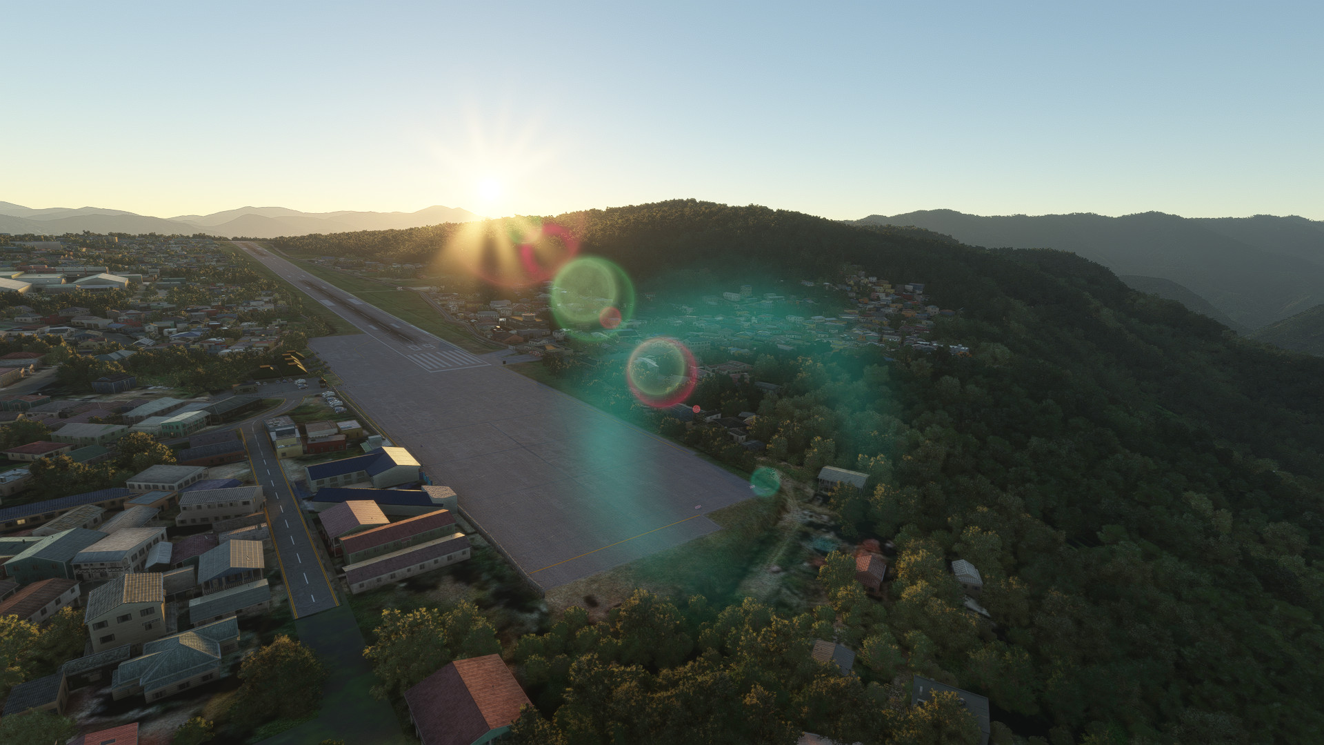
Included the famous Radar at Mt. Sto. Tomas also known as the La Presa Area
RPUB (Loakan Airport) Was also the First Destination/First Flight of the Philippine National Carrier, Philippine Airlines.
IMPORTANT: PLEASE DOWNLOAD DEPENDENCIES
If you feel so inclined, feel free to Buy Me a Coffee - buymeacoffee.com/KER0TIN
Paypal - KER0TIN
DO NOT MODIFY, REDISTRIBUTE, REUPLOAD WITHOUT MY PERMISSION OR I WOULD TAKE PROPER ACTIONS.
Version 3.4:
Final update for FS2020
Removed Custom Waypoints (as it can also be inputted manually in navigraph and other aircraft addons).
Added small changes to reflect current real world appearance of the airport.
Enjoy
Dépendances
Commentaires(23)
Connectez-vous pour participer à la discussion
Se connecterover 1 year ago
about 3 years ago
Thanks for the scenery, but why was it archived?
almost 4 years ago
Any help why the airport grounds are in grass? is it an update problem? same as subic/RPLB. Other airports are Okay. Thanks..
over 4 years ago
Am quite enjoying it. Any ideas on what the approaches and departures are? There's nothing on Navigraph. Would you only takeoff downhill and land uphill or is it either way?
In small aircraft I like following the Bued river through the valley and circling to land in attempt to keep under the clouds. Just not sure if thats likely in real life.
Otherwise in the DC-6 (PAL livery ofcourse) I fly straight-in rwy 09 and depart 27.
over 4 years ago
i watched youtube videos on how they approach the airport since i have not flown to Baguio in real life. but i only see approach on runway 9 so i am not really sure on how to approach runway 27
about 4 years ago
Good idea, I should have thought to check youtube.
over 1 year ago
over 5 years ago
over 5 years ago
over 5 years ago
Sino may gusto dito ng updated Jeppesen Charts message nyo lang ako mgbbgay ako ng latest charts from jeppesen.
over 5 years ago
over 5 years ago
RPUB - Loakan Airport, Baguio City
Experience the detailed recreation of Loakan Airport in Baguio City (RPUB) with added 3D models by TurtleTank1997. Explore the famous Radar at Mt. Sto. Tomas, also known as the La Presa Area. Learn about the historical significance of RPUB, the first destination of Philippine Airlines. Please note that custom waypoints may not work on certain aircraft and with separate navdata/navigraph databases.
Contributeurs
Avis des utilisateurs
11 avis
Location
More Information
Historique des versions
Final update for FS2020 Removed Custom Waypoints (as it can also be inputted manually in navigraph and other aircraft addons). Added small changes to reflect current real world appearance of the airport.
Similaires
RPSP - Panglao Bohol Int'l Airport, Panglao Bohol
Explore Panglao Bohol International Airport (RPSP) in Microsoft Flight Simulator with working ILS on runway 21. This add-on includes accurate real-world airport location and SID/STAR procedures. Discover more in the README file.
par TurtleTank1997, KER0TIN
![[No Mirror] 747-8 Philippine Airlines](https://cdn.flightsim.to/images/14/U0BmE4dq.jpg?width=500)
[No Mirror] 747-8 Philippine Airlines
Fly the iconic Boeing 747-8 in the livery of Philippine Airlines without mirror distortion with this add-on. Get the Salty 747 version for an enhanced flight simulation experience.
par KER0TIN
B787 Philippine Airlines The Love Bus (Fictional)
Experience a fictional twist with the B787 Philippine Airlines The Love Bus. Fly in style with this unique livery inspired by Philippine Airlines, adding a touch of creativity to your flights in Microsoft Flight Simulator.
par KER0TIN
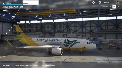
A32NX Cebu Pacific Old Livery
Experience nostalgia with the A32NX Cebu Pacific Old Livery for FS2020 A320 Neo. Relive the classic look of Cebu Pacifics past with this authentic repaint. Follow the creator for more updates and creations.
par KER0TIN
over 1 year ago