
Description
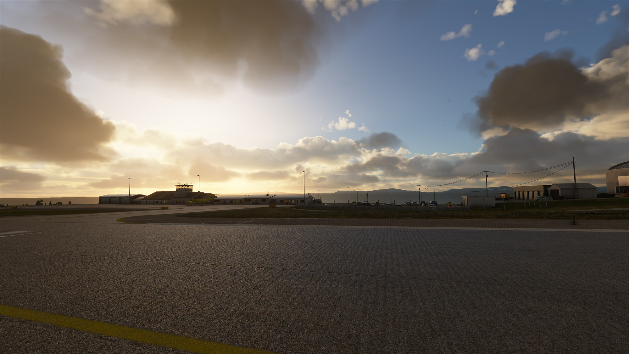
Vadsø Airport serves the 6,000 inhabitants of Vadsø and its neighbouring villages. It is a STOL airport operated by Widerøe DHC-8s, and is often visited by GA and air ambulance King Air B200s. Ceilings here are frequently low, with easterly winds in summer, and south by westerly winds with overcast weather in winter. As with the rest of the Varanger peninsula the climate here is very dry. The 970 meter runway features a challenging 1.5% slope; a 30-40 meter cliff before the 07 threshold; and 4.5 and 4.6 degree glide slopes with localizer for STOL operations.
Airport diagrams freely available at Avinor.no.
This upload completes the Varanger Peninsula collection of airports! If you are interested in STOL airports featuring localizers, VORs, NDBs, and detailed runways, check out some of my other uploads.
V 1.3 Features
- Fix for hills on approach path.
- 100% accurate STOL CALVERT lights.
- Corrected runway slope.
- 4.5 and 4.6 deg PLASI.
- Improved airport markings, parkings, terrain, buildings.
- Improved terrain in the vicinity (deforestation).
Known issues
- Area beyond 1nm of airport has very poor height mapping.
- No satellite imagery.
- Unwanted apron crew and variable fuel station size. Summer 2022 update: Working on it.
- RWY AHEAD shows through snow.
- Couldn't delete enough forests.
Untested with AI.
Thank you to Augustin Winther for help and airport markings. Thank you also to O M Øverland of Cartographica for the WF maps. Thank you to T Mongun for his B350 air ambulance repaint.
A big thanks for any Paypal donations. <3
Location
ENVD - Vadsø Airport, Vadsø
Vadsø ENVD is a STOL airport on the Varanger peninsula of Northern Norway, typically serviced by Widerøe Dash 8-100s. The addon uses the Nordics DLC and default buildings, handcrafted with high attention to runway slope, approach lighting, and other unique elements.


Avis des utilisateurs
9 avis
Historique des versions
Similaires
ENSS - Vardø Airport Svartnes
Vardø Svartnes Airport ENSS is a STOL airport on the Varanger peninsula of Northern Norway, typically serviced by Widerøe Dash 8-100s. The addon uses the Nordics DLC and default buildings, handcrafted with particular attention to runway slope, approach lighting, and approach-adjacent scenery.
par WF971
ENBS - Båtsfjord Airport, Båtsfjord
Båtsfjord ENBS is a STOL airport on the Varanger peninsula of Northern Norway, typically serviced by Widerøe Dash 8-100s. This freeware addon uses the Nordics DLC and default buildings, crafted with meticulous attention to approach lights and runway slope.
par WF971
ENBV - Berlevåg Airport, Berlevåg
Berlevåg ENBV is a STOL airport on the Varanger peninsula of Northern Norway, serviced by Widerøe Dash 8-100s and the occasional King Air B200. This freeware addon uses the Nordics DLC and default buildings, crafted with meticulous attention to approach lights and runway slope.
par WF971
ENME - Meråker Airport Øian
Enhance your virtual aviation experience with the ENME - Meråker Airport Øian add-on, offering a small airstrip fix east of Trondheim Airport Værnes. This mod corrects runway slopes, terrain issues, and adds essential airport features for improved playability. Compatible with additional scenery enhancements for an even more detailed flight simulation.
par WF971
Connectez-vous pour participer à la discussion
Se connecterCommentaires(19)
4 months ago
Looks just like the real airport.
4 months ago
almost 2 years ago
almost 2 years ago
over 2 years ago
over 2 years ago
over 2 years ago
almost 4 years ago
Nice Airport. Is it normal that the runway has no lights at night? Or is this a bug in msfs because i took a flight at 14:00Z but in winter in the north there is no sun so it is dark.
almost 4 years ago
Hi! I see runway lights just fine through 10:00z to 19:00z, maybe you can try reloading/restarting the flight once you have started at the airport? I've seen some light bugs elsewhere that are fixed by loading twice. Other than that I am not sure what could be going on... Thank you for letting me know!
over 4 years ago
SU8 Compatible :) ? I did use it previously, a great airport rendition :)
over 4 years ago
thank you from France
over 5 years ago
Well done! Skypark has started a tour of the country. This is the second stop. Definitely a nice addition to add to the tour. 5 stars to boost it over the 4 star mark =)
over 5 years ago
Thank you so much! What is Skypark?
over 5 years ago
I cannot really explain it other than quote their description of their product "Available exclusively for Microsoft Flight Simulator 2020, The Skypark is a living playground within your sim. Indulge your fantasies of traveling the world by air while working a market of worldwide contracts.
A revolutionary platform for the enjoyment of flight simulation built on a simple concept... Less Planning, More Flying. The Skypark combines characters, contract jobs, tours, and adventures for pilots to use their custom aircraft and scenery collections to reignite their passion for flight."
over 5 years ago
I don't find the total absence of trees that distracting as the bushes that surround the area is well below two meters from my recollect.
I'm thinking I took a pic looking out of the terminal as well when I was there. Should be fun to compare.
Anyhoo, absolutely awesome work. Love it!
over 5 years ago
I am hopeful we can escape the shitty default buildings before too long. =)
over 5 years ago
about 6 years ago
about 6 years ago
Re: trees, definitely on the to-do list. Unfortunately the local bushes almost never top 2m and there's no way to put them in, yet, to my knowledge, without also adding 4-6m birch. Which is virtually nonexistant in Vadsø.
It's a balancing act because either you add birch+bushes in small, manually placed areas, or you let the game place pine trees in the 'right' areas. :( But I hope to find a solution with a later update. =)