
Description
Nanaimo Harbour Water Aerodrome CAC8 - supplement
Nanaimo Harbour Water Aerodrome (ICAO CAC8) is a seaplane base (SPB) serving the city of Nanaimo, British Columbia, Canada. It is located in the Nanaimo Harbour.
It is registered as an aerodrome, formerly classified as an airport, and an airport of entry by Nav Canada.
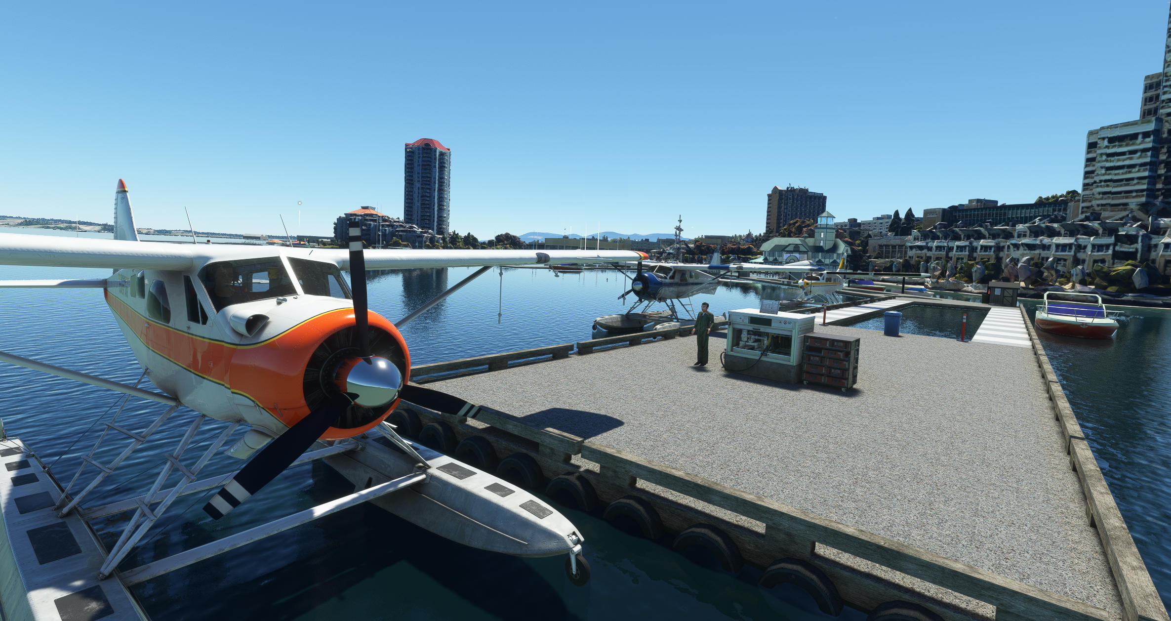
This package is a supplement to the default MSFS airport CAC8 and adds scenery, docks, pontoons, boats and a dock parking place for selection for those ‘cold and dark’ startups.
The original Asobo CAC8 ‘airport’ consists of only water ‘runway’ start/takeoff positions.
NOTE the images are taken with boats from mamu’s marina (see below) installed.
ICAO CAC8
Navigation aids None exist
Location Country CANADA
Province BRITISH COLUMBIA
City NANAIMO
Airport NANAIMO HARBOUR WATER AERODROME
Runway/Starting Positions
Parking position PARKING 1 - DOCK GA parked at dock position 1
PARKING 2 – DOCK GA parked at dock position 2
Coordinates 49.169956 -123.93505
CREDITS
Bob May of Premier Aircraft Design – DHC3T Otter amphibian (ex FSX)
Please note that while Bob granted me permission to use his aircraft to rebuild into a static model for MSFS2020 it should not r regarded as freeware.
Bob gave me permission in a message sent from flightsim.com on 20230710
Martin Clark For his input of the roof of the Nanaimo Lighthouse Terminal building.
Blender
Google maps 3D satellite imagery
INSTALLATION INSTRUCTIONS
Unzip folder named NANAIMO WATER AIRPORT to a temporary folder
PLEASE NOTE if you are updating the previous version then it is suggested that you REMOVE folder named “jarnie-airport-cac8-nanaimo” before copying the new version.
copy the “nanaimo-airport-cac8-jarnie” folder into your FS2020 COMMUNITY FOLDER This module contains the docks, departure dock parking and Lighthouse bistro and pub.
copy the “nanaimo-3d-cbd-jarnie” folder into your FS2020 COMMUNITY FOLDER
This module displays the 3d satellite imagery of Nanaimo CBD
NOTE if MSFS runs too slow then remove this folder however that will
result in no 3d imagery of Nanaimo CBD
Copy the “nanaimo-3d-other-jarnie” folder to you FS2020 COMMUNITY FOLDER
This module displays the 3d satellite imagery of Nanaimo south side of Nanaimo
NOTE if MSFS runs too slow then remove this folder however that will
result in no 3d imagery of Nanaimo CBD
Also note that none of the above are dependant on the others. You can choose to install any
one or as many as you want.
OPTIONAL
Most of the scenery objects (boats at pontoons) will only appear if you download and install the following (all available at flightsim.to)-
Mamudesign - Marinas by mamu most of the static boats HIGHLY RECOMMENDED
Please NOTE that as at 20240401 this addon is no longer available at flightsim.to It is available at https://mamudesign.eu/shop/
Version 1.0:
- Docks and static aircraft
- 1 parking spot IN USE
Version 2.0:
- Addition of more realistic shed on docks.
- Removal of the decommissioned parking dock and addition of parking dock 2
- Addition of the Nanaimo Lighthouse Restaurant and Seaplane Terminal building. I have included some lighting in the buildings although this is not a 24 hour airport. The Terminal building was the most complex model I have ever created with walls which do not follow the ‘shape’ of the roof, heaps of different separate walls and many walls angled
- Addition of 3D satellite imagery of the CBD of Nanaimo taken from maps.google
Note that this imagery is quite low resolution.
- Addition of 3d satellite imagery of the south side on Nanaimo including McGregor Park
Note that this imagery is quite low resolution.
- Replaced the DHC3 static floatplane with a DHC3T static floatplane.
Version 2.1:
- Mask library objects on north dock
- Add floating logs east of Nanaimo
Version 3:
Filename change to prevent conflict with mamu’s marinas addon.
Version 4.0:
- Mods to make it FS2024 ‘friendly’ including extra package to level water.
This scenery is freeware and must not be distributed for gain.
Let me know if you see need of improvement or have any issues with the package.
It has been tested with MSFS2020 World Update 13 (1.33.8.0) as at 12 July 2023.
Check out my other water airports at SECHELT, VANCOUVER HARBOUR, WHISTLER. LAKE POWELL
Dépendances
Nanaimo Harbour Water Aerodrome Canada - Supplement
Nanaimo Harbour Water Aerodrome (ICAO CAC8) is a seaplane base (SPB) serving the city of Nanaimo, British Columbia, Canada. It is located in the Nanaimo Harbour. It is registered as an aerodrome, formerly classified as an airport, and an airport of entry by Nav Canada. This package is a supplement to the default MSFS airport CAC8 and adds docks, pontoons, boats and a dock parking place for selection for those ‘cold and dark’ startups. The original Asobo CAC8 ‘airport’ consists of only water ‘runway’ start/takeoff positions. Please read the documentation for warnings.

Avis des utilisateurs
1 avis
Historique des versions
Version 4.0: - Mods to make it FS2024 ‘friendly’ including extra package to level water.
Présent dans des collections(1)

Similaires
CAX3 Sechelt/Porpoise Bay Water Aerodrome - CBP4 Sechelt Hospital Helipad
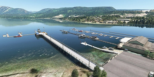
CAX3 Sechelt/Porpoise Bay Water Aerodrome Sechelt is a small town on the lower Sunshine Coast of British Columbia, Canada situated between the Strait of Georgia and the southern end of Sechelt Inlet. Sechelt/Porpoise Bay Water Aerodrome was an aerodrome located adjacent to Sechelt, British Columbia, Canada. The airport was listed as abandoned in the 15 March 2007 Canada Flight Supplement. It is located around 3.2 kilometers (2 miles) WNW of Sechelt-Gibsons airport. Whilst the aerodrome has been closed, the Sechelt Inlet/Porpoise Bay area is still used daily by private airline operators including Harbour Air.
par jarnie
CYHC Vancouver Harbour Airport Canada
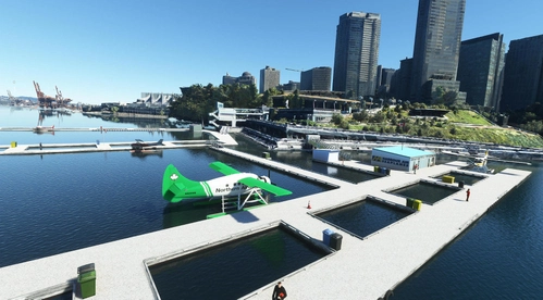
Explore an enhanced version of CYHC Vancouver Harbour Airport with this freeware add-on. Featuring docks, static aircraft, a radio mast, and more, this scenery brings a new level of realism to your flights in the Vancouver area. Enjoy 6 parking spots, 2 take-off points, and detailed textures for a more immersive experience in MSFS2020 and MSFS2024.
par jgplarnold
CAE5 Whistler/Green Lake Water Aerodrome Seaplane Base Canada
Whistler/Green Lake Water Aerodrome Seaplane Base is a small seasonal water airport located about 3 kilometers from Whistler, British Columbia, Canada used by floatplanes in warmer months when Green Lake is clear of ice (don’t try to take off or land during winter). It is currently used by Harbour Air and Whistler Air (subsidiary of Harbour Air) aircraft.
par jarnie
CAQ8 Powell Lake Seaplane Base - supplement
Powell Lake Seaplane Base is a small seaplane base located on Powell Lake, British Columbia, Canada and serviced by Harbour Air with flights to Vancouver.Adds docks and Dock Gate start location to default CAQ8 airport which allows pilots do a cold and dark startup.
par jarnie
Connectez-vous pour participer à la discussion
Se connecterCommentaires(25)
about 6 hours ago
about 7 hours ago
about 15 hours ago
"If you have FS2024 then –
Copy nanaimo-cac8-2024-water into your FS2024 Community Folder.
This goes close to correcting the weird water levels in the area.
Do NOT copy it to your FS2020 Community Folder as it will result
in very weird water levels."
So, IIUC, CAC8 water in Asobo's MSFS 2024 is now 'on-the-level'.
But Altitude AMSL is still incorrect to IRL.
Asobo should fix MSFS 2024 Altitudes in this region.
Southern Canada LIDAR HRDEM Altitudes are still incorrect to IRL; 'Mosiacs' are also not edge-aligned.
3 days ago
Oct 7, 2026
Thanks for your encouragement to try and fix the incorrect altitudes on the water area at Nanaimo. I have never used QGIS before and so I am stumbling. After researching on Youtube it seems I need to create a shapefile in QGIS, is that correct? I will need to follow a few Youtube tutorials. And after I create a shapefile I need to learn how to use it in MSFS Devmode. This is going to be a huge learning curve I think.
11:53 PM
And which template in QGIS do I open with Blank or OPenStreetMap? Does it matter?
11:58 PM
Oct 8, 2026
Sorry another one. I can't even find a Youtube tutorial how to create a shapefile only one showing how it is not required and so I don't know what (in QGIS) to select for say File Encoding (eg UTF or System or whatever. And why am I even bothering as no one apart from yourself has even bothered to either thank me etc for my freeware?
12:11 AM
Does flightsim.to have a forum for communication other than via this page or "text messaging" ?
If so, we can better discuss workflow options if you wish to correct MSFS' Nanaimo water and terrain.
I do not use QGIS, but I can point you to tutorials for QGIS and other GIS enabled FS scenery utilities.
I may not have time this week to personally make a "worked example" water flatten using MSFS SDK.
After creating an ESRI SHP file water flatten Polygon from Canada HRDEM DTM generated contours, the data can be inspected / edited in QGIS and/or SBuilderX v3.15 using BING imagery as a background map.
NOTE: HRDEM elevations may have invalid Altitude data on offshore water bodies outside LIDAR scan areas.
One uses a GIS vector tool to draw poly-line(s) joining seawater shore contours, to form a 'closed' Polygon.
After a ESRI SHP file water flatten Polygon is finalized for testing, it can be imported into a MSFS SDK project.
Properties of the ESRI Shapefile imported to MSFS SDK as a 'primitive' Polygon are updated to 'terraform'.
But first, in MSFS SDK, test a low-res terraforming water flatten for Nanaimo area Edit > check [X] Save Polygons In Shapefiles > save vectors into a *.SHP file:
(See results for a Google Search via this Google query string:) MSFS SDK save vectors as shapefiles
BTW: You may wish to review this info in MSFS 2020 SDK Docs regarding *.SHP shapefiles:
https://docs.flightsimulator.com/html/Introduction/Using_The_SDK.htm?rhhlterm=shapefiles
https://docs.flightsimulator.com/html/Samples_And_Tutorials/Samples/Sceneries/SimpleBiomes.htm?rhhlterm=shapefiles
On the latter MSFS 2020 SDK Docs linked page, click on: File Overview
...for an example "SimpleBiomes" file / folder structure showing where we must save *.SHP vector data:
|---+ PackageSources
| |---+ scenery
(...in other words, always save a *.SHP into: [Project_Name]\PackageSources\Scenery sub-folder)
FYI: You may also be able to make a replacement 'sloped flatten' TIN mesh to correct terrain land areas.
In a separate QGIS process one may Triangulate LIDAR DTM contour Polygon vertices into a TIN surface
Thus water and land elevations for Nanaimo area may both be re-configured to match IRL more accurately.
7 days ago
In QGIS one can derive 1 or more Polygons from contours for Seawater shorelines
Seawater shoreline contour lines can be joined to make 1 or more local Polygons.
Change LiDAR GIS CRS / Projection to EPSG:4326; export contour Polygon(s) as ESRI Shapefile(s).
Import ESRI Shapefile Polygon(s) to MSFS SDK; assign to Terraforming at 0-Meters Altitude AMSL.
Terraforming Polygons set at 0-Meters AMSL can Terraform / flatten all seawater at / near Nanaimo.
https://www.fsdeveloper.com/forum/threads/can-change-in-water-level-be-fixed.454181/post-894707
...shows how to make a "lake" Terraforming Polygon; this same process is required at Nanaimo / Vancouver.
7 days ago
12 days ago
https://www.fsdeveloper.com/forum/threads/what-the-best-way-to-remove-rocky-photogrametry-monolith-trees.455740/
Thalixte's "GEDOT" 3D model-based Photogrammetry (IMHO, more like 3D G-Polys) requires use of ExclusionRectangles:
Google query string: site: www.fsdeveloper.com GaryGB "GEDOT" "faux" photogrammetry
Of particular note may be this thread:
https://www.fsdeveloper.com/forum/threads/possible-to-remove-a-certain-area-from-a-3rd-party-photogrammetry-area.459478/
IMHO, all MSFS Photogrammetry must be placed over flat / level terrain flattens made via terraforming Rectangles and / or Polygons.
This allows correct shoreline / water surface to be maintained at 0 Meters AMSL to correlate with "terrain" Altitudes IRL.
However, we must note Nanaimo Harbor Walkway is 'X' Meters AMSL IRL:
https://lh3.googleusercontent.com/grass-cs/ACvplmNQp5UnvCiWYGD6LiHTJ28OyRB_fbwmIbnPb4AYTMnDL0JrQjVzdiCaJg5NRglr0cYAEUi50BLPiY8xXKBrRIt8oWBJ30xZ5h9PZPf3QPw9vueCzuRFgSBAVHQpfRkeUHKsa_6Z7w=h1440
Otherwise we may have Quick-and-Dirty 'sloped water' scenery that is an insult to seaplane aviation if used in a "true" Flight Simulator
NOTE: Caution is required as excluding MSFS default TIN Photogrammetry may impact aerial imagery transitions on terrain:
https://www.fsdeveloper.com/forum/threads/custom-aerial-texture-below-the-default-one.460828/post-940036
12 days ago
13 days ago
DevMode Menu > Debug > Display Position > Altitude values do not correlate with FS' "True" Terrain / Water surface levels...
To verify this using rhumbaflappy's TCalc_004 for MSFS:
Browse to: https://www.fsdeveloper.com/forum/attachments/tcalc_code-zip.61804/
Download / un-ZIP / Run: [download_path]\TCalc_Code.zip\bin\Release\TCalc_004.exe
Take note of changes to the "Ground Altitude" value in Meters within TCalc_004 GUI ;-)
...then toggle "Enable Terraforming" ON / OFF via:
DevMode Menu > Options > Ground Options > Check: Enable Terraforming, Enable Water Flattening, Altitude Isoline (= Incorrect AMSL)
DevMode Menu > Options > Ground Options > Check: Enable Terraforming, (DIS-able Water Flattening), Altitude Isoline (= Correct AMSL)
Thus, using AGL / Snap-To-Ground placement is contra-indicated until after:
"an update by MS-Asobo, or extensive custom terraforming work by a 3rd party FS Developer."
IMHO, custom terraforming work to fix sea level at CAC8 'should' use flat / level Rectangles / Polygons all at (1) Altitude
You can either place floating dock(s) AMSL:
Google query string: MSFS SDK place scenery object AMSL
...or custom terraform CAC8 local terrain and water level yourself.
IMHO, do NOT use sloped terraforming Rectangles or Polygons as was IIUC, used by Asobo in MSFS default.
IMHO, do NOT use sloped terraforming Rectangles as was IIUC, used by Thalixte to accommodate 'mis-placed' Photogrammetry:
https://www.fsdeveloper.com/forum/threads/can-change-in-water-level-be-fixed.454181/post-894700
13 days ago
15 days ago
https://www.fsdeveloper.com/forum/threads/strange-water-levels-between-2020-and-2024.461188/post-942418
....you may wish to review your prior thread here:
https://www.fsdeveloper.com/forum/threads/can-change-in-water-level-be-fixed.454181/
14 days ago
20 days ago
https://www.fsdeveloper.com/forum/threads/strange-water-levels-between-2020-and-2024.461188/#post-942330
CAC8 Water Surface Altitude is 0 Meters AMSL IRL according to:
https://en.wikipedia.org/wiki/Nanaimo_Harbour_Water_Aerodrome
MSFS 2024 default "TIN" Photogrammetry disabled ...still shows CAC8 Water Surface Altitude is not correct to IRL.
To fix this requires an update by MS-Asobo, or extensive custom terraforming work by a 3rd party FS Developer.
Custom 3D model "Photogrammetry" placement must also be adjusted so shorelines end up at 0 Meters AMSL.
20 days ago
8 months ago
For the Water bump, here are some pictures. I wanted to find out if I could fix it myself and it is possible to flatten a lof of the water but there is this one huge bump which I didn't manage to flatten. Seems to be the peak. Tried around with Polygons and ExclusionRectangles but I didn't get it to work.
The first two picture are without any fixes I tried. The third one is with what I tried but like I said there is this huge bump there that I can not get rid of. Last one is just the area where it is. Hope that helps
8 months ago
8 months ago
9 months ago
8 months ago
Are you using the paid version of mamu's marinas? If so there is a conflict which results in parked aircraft being shoved up in the air. I will upload a mod but in the meantime remove/delete all my nanaimo scenery files all of which are prefixed with jarnie (there are 3 of them). RENAME the files you downloaded by changing the word jarnie to naniamo then copy to the community folder. Let me know.