Description
Mai 2026 : Nouvelle version de la scène du Mont-Pilat (France – Loire) et de l’altisurface de la Jasserie LF4222, entièrement modélisée avec Blender 3D avec des textures PBR et implantée avec le SDK de MSFS.
Version hybride compatible avec MSFS2020 et MSFS 2024
LF4222 La Jasserie
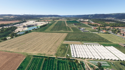
Altisurface situé à 4550 pieds (1387 m), piste en herbe très technique et pentue de 430 m de long sur 25 m. L’atterrissage se fait dans le sens Piste 18 (sens de la montée). Le décollage dans le sens Piste 36 (en descente)
S’annoncer de son intention sur la fréquence : 130 Mhz
L’utilisation de la piste est déconseillée par un vent du Sud > 10 nœuds.
Dans MSFS chercher le code OACI : L4222
Commune de la Jasserie du Pilat :
Ferme auberge historique entièrement reconstituée en 3D.
Anciennes Stations de Skis
(réalisation 3D par IronEagles avec son aimable autorisation ):
Implantation des vestiges des anciennes stations de skis de la Jasserie:
- Remontée du Panisset 1937 – 1940
- Remontées de la Cuvette 1967 - 1992
Mémorial crash du 1er novembre 1944 du Dakota C47 Américain
(réalisation 3D par IronEagles avec son aimable autorisation ) :
Au bord de la route juste avant le dernier virage avant la Jasserie se dresse un mémorial en souvenir du Douglas C47 américain (évacuation sanitaire) qui s’est écrasé le 1er novembre 1944 par mauvais temps entre le crêt de Botte et le crêt de la Perdrix..
Des honneurs sont rendus chaque année, en la mémoire des 14 soldats américains, mais aussi des 6 soldats allemands qui ont perdu la vie ce 1er novembre 1944
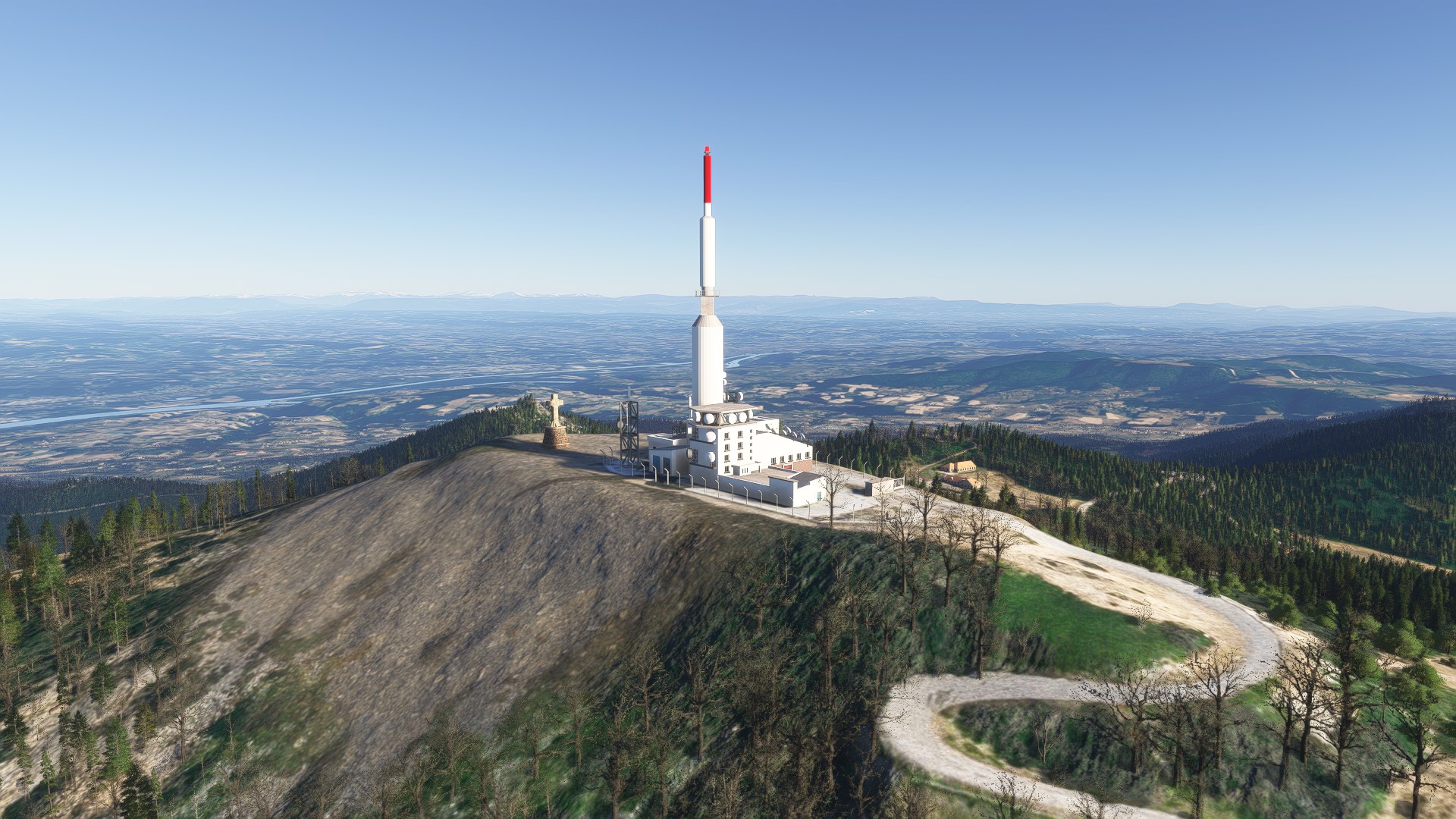
Emetteur du Pilat :
Situé à 1363m d’altitude sur le Crêt de l’ Oeillon. Implanté depuis 1955, émetteur de diffusion de la télévision numérique et de la radio des plus puissants de France (derrière la tour Effel ), son antenne principale fait 80 m de haut.
Croix de l’Oeillon :
Dominant la vallée du Rhône, cette croix monumentale de 10 m de haut sans sa base, fut charriée par des attelages de bœufs et érigée en 1867 sur la crête de l’Oeillon (1364m ) .
Crêt de Botte :
Situé à 1391m d’altitude voisin de l’émetteur du Pilat. Reconstitution en 3D d’un ancien bâtiment militaire.
Bons Vols dans notre région AUvergne-Rhône-Alpes.
Découvrez mes scènes prémium pour MSFS2020 et MSFS2024
Mon site WEB : https://auramsfs.e-monsite.com/
Ma chaine YouTube : https://www.youtube.com/@auramsfs4037/videos
Mon site Facebook : https://www.facebook.com/profile.php?id=100076518340632
Conditions d'utilisation de la scène : https://auramsfs.e-monsite.com/about/cgu/
MERCI POUR VOTRE SOUTIEN
Dominique AURA-MSFS - DOMTOM69
May 2026: New version of the Mont Pilat scenery (France – Loire) and the La Jasserie mountain airstrip LF4222, fully modeled with Blender 3D using PBR textures and implemented with the MSFS SDK.
Hybrid version compatible with MSFS2020 and MSFS2024.
LF4222 La Jasserie, mountain airstrip:
located at 4,550 feet (1,387 m), very technical and steep grass runway 430 m long and 25 m wide. Landing is in the direction of Runway 18 (the direction of climb). Takeoff from Runway 36 (downhill)
Announce your intention on frequency: 130 MHz
Runway use is not recommended in southerly winds exceeding 10 knots.
In MSFS, search for the ICAO code: L4222
La Jasserie du Pilat:
Historic farmhouse inn, fully reconstructed in 3D.
Former Ski Resorts:
(3D model by IronEagles with their kind permission)
Location of the remains of the former Jasserie ski resorts: +
- Panisset Lift : 1937-1940
- Cuvette Lifts : 1967-1992
Memorial to the crash of the American Dakota C-47 on November 1, 1944
(3D model by IronEagles with their kind permission):
At the roadside, just on the last bend before La Jasserie, stands a memorial to the American Douglas C-47 (medical evacuation) that crashed on November 1, 1944, in bad weather between Crêt de Botte and Crêt de la Perdrix. Honors are paid each year in memory of the 14 American soldiers, as well as the 6 German soldiers who lost their lives. Life on November 1, 1944
Pilat Transmitter:
Located at an altitude of 1363m on the Crêt de l’Oeillon. Established in 1955, this transmitter, one of the most powerful in France for broadcasting digital television and radio (second only to the Eiffel Tower), has a main antenna 80m high.
Croix de l’Oeillon:
Dominating the Rhône Valley, this monumental cross, 10m high without its base, was transported by teams of oxen and erected in 1867 on the Crêt de l’Oeillon (1364m).
Crêt de Botte:
Located at an altitude of 1391m, near the Pilat transmitter. 3D reconstruction of a former military building.
Have a good flight in our Auvergne-Rhône-Alpes region.
Discover my premium scenes for MSFS2020 and MSFS2024
My website: https://auramsfs.e-monsite.com/
My YouTube channel: https://www.youtube.com/@auramsfs4037/videos
My Facebook page: https://www.facebook.com/profile.php?id=100076518340632
Scene terms of use: https://auramsfs.e-monsite.com/about/cgu/
THANK YOU FOR YOUR SUPPORT
Dominique AURA-MSFS - DOMTOM69
Commentaires(38)
Connectez-vous pour participer à la discussion
Se connecterabout 1 month ago
about 1 month ago
La méthode ZZZ fonctionne , mais la plus efficace est de renommer la scene FranceVFR 0_sceneFranceVFR , elle se chargera en premier .
about 2 months ago
Magnifique, je suis sur que si on y prête attention ça sent la caillette et le saucisson sur la terrasse de la Jasserie tellement c'est réel.
Superbe travail comme d'habitude.
It’s magnificent. I’m sure that if you really pay attention, you can almost smell the ‘caillette’ and the sausage on the terrace at La Jasserie – it’s that lifelike.
Superb work, as always.
about 2 months ago
about 2 months ago
about 2 months ago
On a tout ce qu'il faut, avec modération, dans la région.
about 2 months ago
a great job again as usual
thanks for your contribution for the simmer community
about 2 months ago
LF4222 La Jasserie – Mont Pilat (MSFS2020-MSFS2024)
Explore the detailed scenery of Mont Pilat and the La Jasserie LF4222 altiplane in MSFS2024. This add-on features an intricately modeled steep grass runway at an elevation of 4,550 feet, designed for technical landings and takeoffs. Key landmarks include the historic Pilat transmitter and the Oeillon Cross, providing an immersive experience in the Auvergne-Rhône-Alpes region. The add-on utilizes advanced PBR textures, all implemented through the MSFS SDK.

Soutiens
Avis des utilisateurs
10 avis
Location
More Information
Historique des versions
VERSION HYBRIDE pour MSFS2020 et MSFS2024 - Ajout commune de la Jasserie du Pilat - Ajout du Crêt de Botte (Station Militaire) - Ajout Anciennes remontées de Ski de la Jasserie 1937-1992 - Ajout Mémorial crash du 1er C47 Américain - Personnages animés - modification végétation
Similaires
LFLR Saint Rambert d'Albon MSFS2020
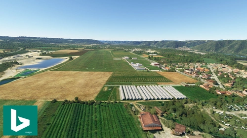
Explore the LFLR Saint-Rambert-dAlbon V2.8 add-on featuring a small aerodrome in the Rhône Valley, halfway between Vienne and Valence. Enjoy VFR navigation, two grass runways, a new fuel station, and various aircraft parking options. Enhance your flight simulation experience with this detailed scenery and share your feedback with the community.
par Domtom69
LFHJ Lyon-Corbas (AERIAL TEXTURE)
Aerial texture (20 cm) for LFHJ Lyon-Corbas, part of an premium scenery .
par Domtom69
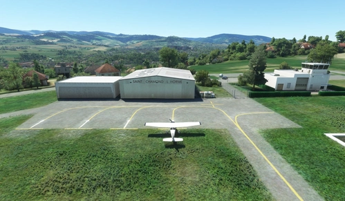
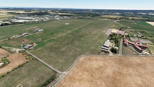
LFHG Saint-Chamond L'Horme MSFS2020
Explore LFHG Saint-Chamond LHorme, a detailed recreation of a civil aerodrome in the Loire region of France. Perfect for leisure and light aviation activities with an uncontrolled grass runway. Discover more French scenery by the developer and share your feedback with the community.
par Domtom69
LFLR Saint-Rambert d’Albon – Tour d’Albon MSFS2024
This add-on for MSFS 2024 features an authentic recreation of the LFLR Saint-Rambert dAlbon airfield and the nearby Medieval Tower of Albon in the Auvergne-Rhône-Alpes region of France. The airfield supports leisure and tourism activities, equipped with two grass runways. The tower, located on a hill overlooking the Rhone Valley, has historical significance dating back to the 11th century. The scenery is crafted using Blender 3D with PBR textures.
par Domtom69
about 1 month ago