

Description
This unique part of the training estate is used by both pilots in training and more experienced members of the RAF and NATO.
It is an air-to-ground bombing and strafing practice area and also offers a beach environment for crews to establish Temporary Landing Zones to practise natural surface operations.
I quickly made this after i read that the RAF had landed an a400 on Pembrey Sands, the runway has some temporary marker lights, start points on the runway and a parking spot, I have also added some targets and tanks and old Jaguars on the bombing range along with a couple of helipads.
ICAO code is AWRP
I have used assets from the following packs
https://flightsim.to/file/24130/uk-emergency-models-library
i will keep adding more in the future
Pembrey Air Weapons Range
Explore the Pembrey Air Weapons Range in Microsoft Flight Simulator, used for air-to-ground training by RAF and NATO pilots. This add-on features a bombing and strafing practice area, beach environment for practicing natural surface operations, targets, tanks, old Jaguars, and helipads. ICAO code: AWRP. Assets from various packs have been utilized in its creation for a realistic experience.


Soutiens

Avis des utilisateurs
1 avis
Historique des versions
added second runway on the beach next to the Air Weapons Range, a few more targets out on the range too and an additional parking spot
Présent dans des collections(1)

Similaires

HMS Queen Elizabeth Carrier CATOBAR Conversion (Project Ark Royal) DEMO
Experience the proposed CATOBAR upgrade of the HMS Queen Elizabeth with this mod. Features include catapult and arrestor wires, ILS frequency of 109.950Mhz, and static locations in the English Channel and Persian Gulf. Simply unzip the contents into your Community Folder to enjoy this conversion project.
par ANSMedia
BA113 - Saint Dizier Airbase LFSI
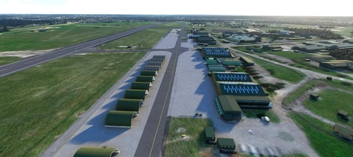
Explore the BA113 - Saint Dizier Airbase LFSI add-on for Microsoft Flight Simulator, featuring a detailed virtual representation of the airbase with 3D modeled buildings and static devices. Enjoy a photorealistic panel integrated using the MSFS SDK, with continuous updates planned based on gathered information and MSFS modifications. This freeware scenery is a collaborative effort with acknowledgments to various contributors for their support and assistance.
par fafa_2021
Dog Bone Lake - BONE, Nevada USA
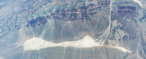
Explore Dog Bone Lake (BONE, Nevada, USA): a custom-made location designed for cargo drops using the C-17 as part of the Virtual Air Forces Red Flag exercise by Destroyer.
par nickb007
RAF Coltishall
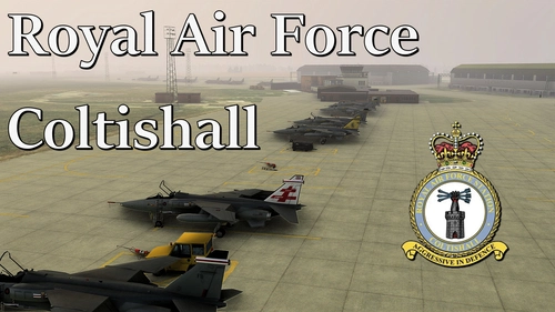
RAF Coltishall is a simulation add-on for Microsoft Flight Simulator that recreates the former Royal Air Force base, specifically during the 2003/04 period when it housed the Jaguar force. While the scenery is a work in progress and not yet fully complete, users can still operate from the base. Future updates are planned, and although designed for MSFS2020, it may function in MSFS2024, pending further testing.
par DaleRFU
Connectez-vous pour participer à la discussion
Se connecterCommentaires(18)
about 4 hours ago
Firstly than you for your hard work , I really appreciate it , Please don't think this a criticism but this is not Pembrey , its Pendine weapons range ,The test missiles on the rocket sledges etc there , the Pembrey MOD range is over the estuary to the east along the coast , that's where the disused Jaguars are with the tower used for live air to ground firing and where they conduct landings on Cefn sidan sands , Pembrey West Wales airport is there along with the Welsh motorsports centre , I used to fly my light aircraft out of there a few years ago , If I can help you with pictures / info let me know
regards
about 4 hours ago
about 1 year ago
about 1 year ago
about 1 year ago
about 2 years ago
about 2 years ago
over 2 years ago
When they do tactical landing they don't use runway lights, they put out large inflatable orange shapes to mark the edge of the runway, you could probably use the same model as the orange targets at Tain
Hope this helps
over 2 years ago
about 3 years ago
about 3 years ago
Thanks for proving this. The majority of beach landings occur on Pembrey Sands which is on the east side of the estuary.
Currently, this scenery has the beach landing strip on the west side of the estuary at Pendine Sands rather than Pembrey Sands.
If you look at 51.71450810423924, -4.366966967518455 you'll be able to see the ATC tower. The Jaguars are located at 51.72536182312315, -4.370944200758764
This might also be helpful to you - https://insidedio.blog.gov.uk/2017/09/25/firing-at-ground-targets-pembrey-sands-air-weapons-range/
about 3 years ago
about 3 years ago
about 3 years ago
about 3 years ago
about 3 years ago
over 3 years ago
about 3 years ago